Soar The Flight Simulator X Skies Above Los Angeles, San Diego and 18,000 square miles of high-resolution, hyper-real, aerial photo-scenery of Southern California.
ENTIRELY NEW Los Angeles, San Diego and Surrounding Areas All Recreated From Aerial Photography At 1 Foot Per Pixel Source Resolution for Microsoft Flight Simulator X.
The MegaScenery Team raises the realism ante again with the first "LARGE AREA" MegaScenery release - MegaSceneryX: Southern California For Microsoft Flight Simulator X. This is our most asked for scenery from flight simmers around the world... and it's now here!
At 18,000 square miles this new title for Flight Simulator X displays scenery at 1.19 meters per pixel - 16 times the resolution of Flight Simulator 2004. MegaSceneryX for FSX is now hyper-real and FINALLY gives you the scenery world you've dreamed of flying on your PC.... that is, a scenery world that is pretty much as real as real life itself!
Flying VFR over Southern California with MegaSceneryX now takes on a whole new level of realism and clarity.
Say Goodbye To Default Flight Simulator Scenery Forever! Soar the skies above Los Angeles, San Diego and 18,000 square miles of Southern California with a Flight Simulator X world that’s more realistic than anything you’ve ever flown on your PC...
MegaSceneryX: Southern California is the clearest, crispest and realistic photo-scenery ever produced for Microsoft Flight Simulator X.
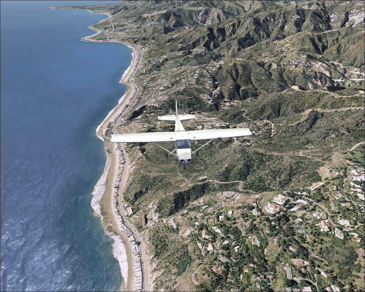
Created from 1 foot per pixel source aerial photographs, this product enables you to experience - for yourself - flight above some of the most visually spectacular terrain in the USA – Southern California - at a level of clarity that you've never seen it before on your PC.
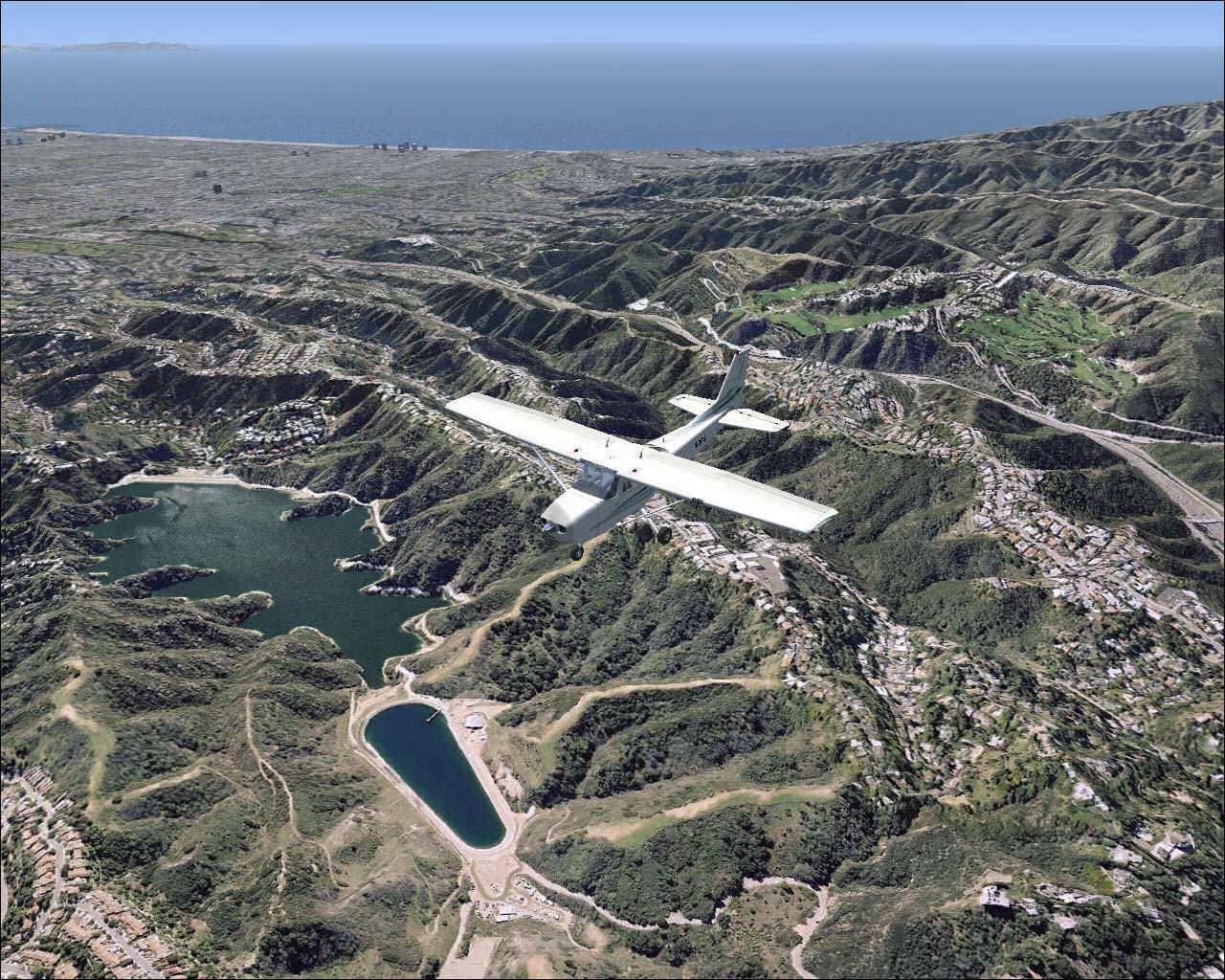
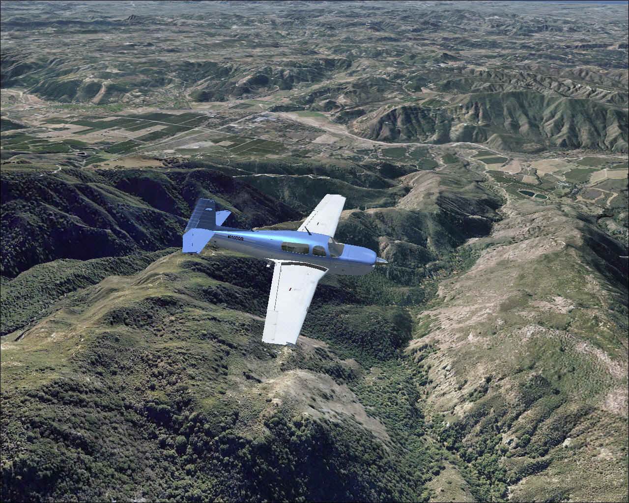
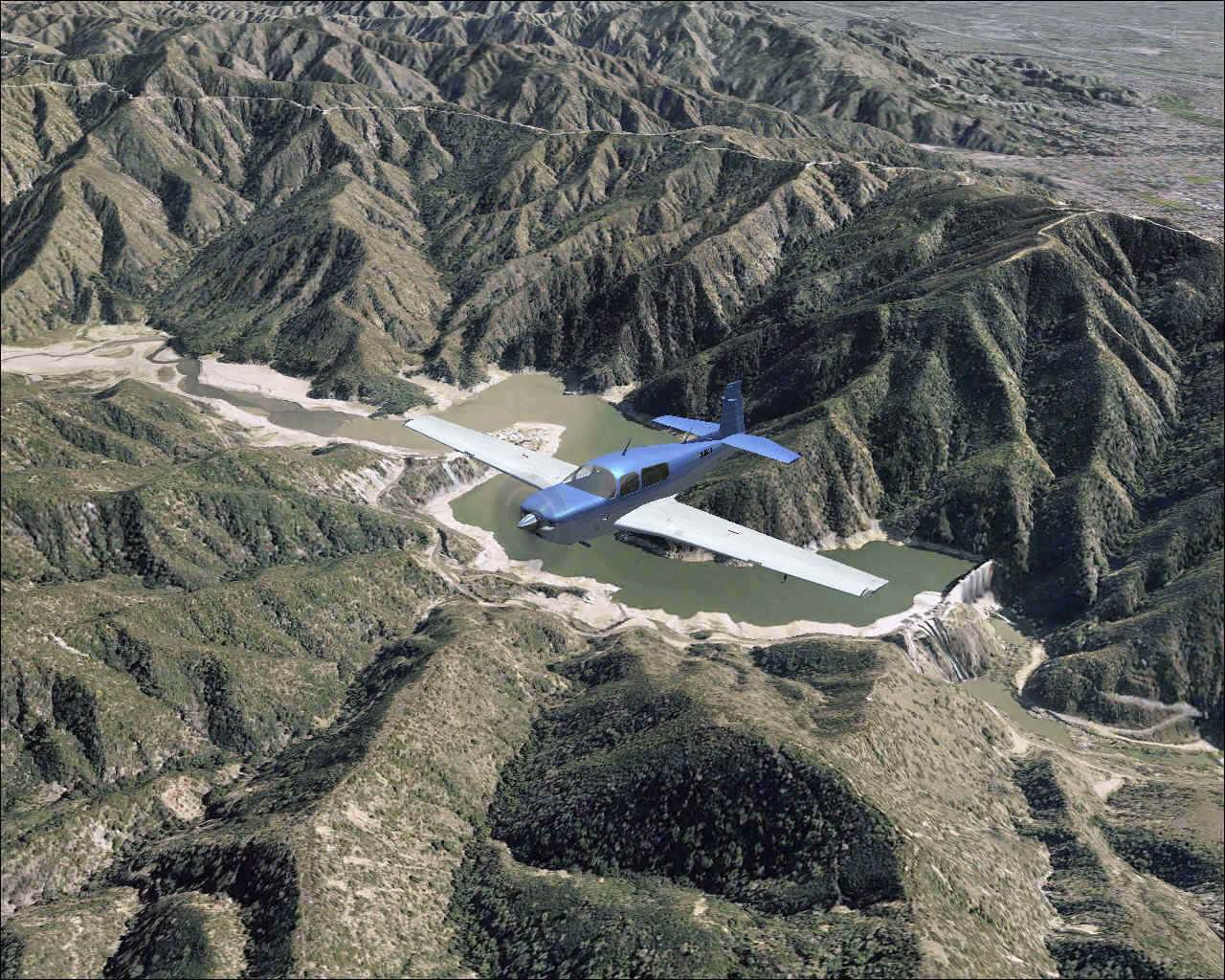
Over 18,000 square miles (135 nm x 135 nm) of photo-scenery day and night scenery lets you explore this visually picturesque area of the United States. From 10,000+ feet mountain peaks, to arid desert, to the Los Angeles urban jungle and even across the water flights to Santa Catalina Island.
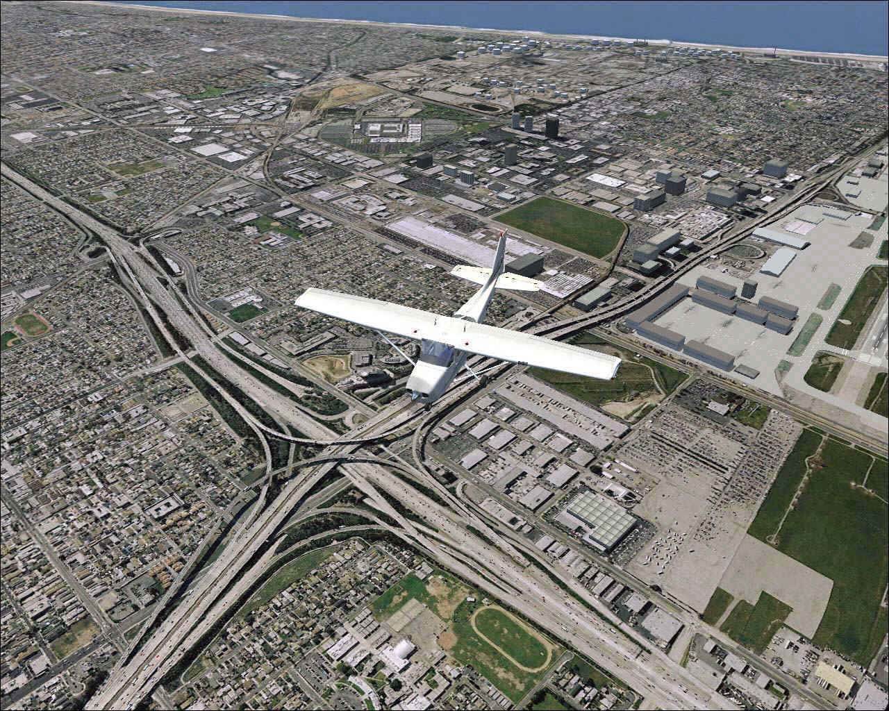
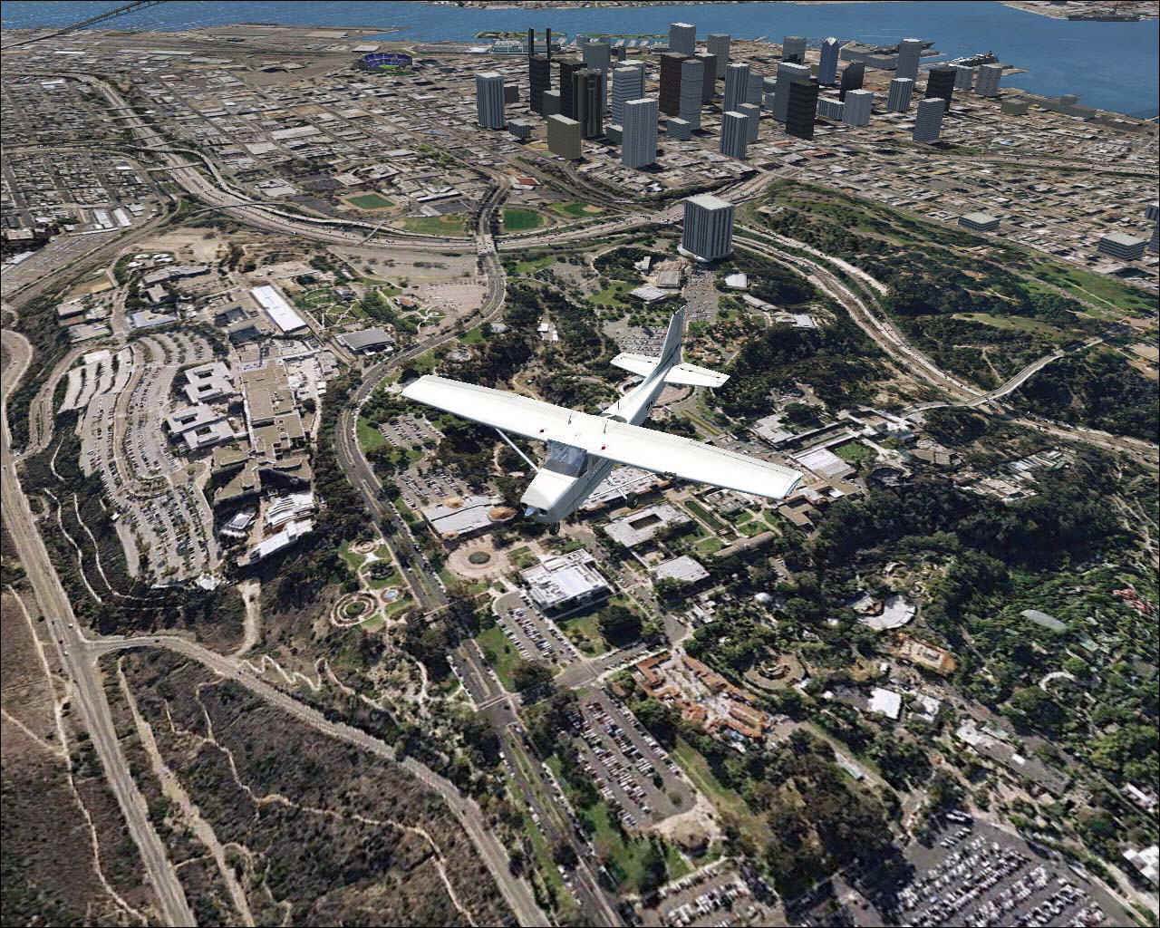
This scenery is developed from high resolution (1 foot per pixel) aerial photography and will have you spotting even the finest details down to individual rooftops and even small trees and and sandtraps on golf courses and vehicles on interstates. This scenery is 16 times the clarity and resolution of that of the FS2004 version.
DOZENS OF AIRPORTS AND SPECTACULAR SIGHTS TO SEE
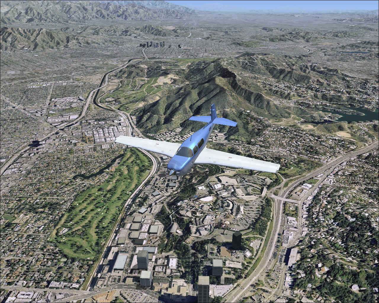
Los Angeles International airport is the West Coast gateway to the USA and as a result supports hundreds of international arrivals and departures daily! Add to that the dozens of smaller and larger regional airports in the immediate area and you've got some very challenging flying in very busy airspace. Los Angeles is a big city and you get to feel like you're actually there because what you're getting is a REAL Los Angeles, a REAL San Diego and REAL surrounding area. yet just a few miles away you get to enjoy the peace and quiet as you depart for the mountains or across the water to Santa Catalina Island.
There's truly some spectacular sites to see such as 14,000 Mt San Jacinto, Big Bear City, Mt Baldy and more! Not to mention some of the famous places in Los Angeles such as Malibu, Beverly Hills, Manhattan Beach and just so much more.
Major landmarks and sights include: Palm Springs, Mt San Jacinto & Agua Caliente Indian Reservation, Mt Baldy, Malibu, Beverly Hills, Catalina and San Clemente Islands, Manhattan & Redondo Beaches, Santa Ana Mountains, Lakes Arrowhead, Elsinor, Big Bear lake, San Gabriel Reservoir, San Diego, Los Angeles, Canyons, Mountains, Desert and everything else the Los Angeles Basin is famous for. If you can see it in real life... you'll see it in MegaSceneryX: Southern California.
2 SCENERY PRODUCTS IN ONE GIVE YOU A TOTAL OF 36,000 Square Miles Of Unique Scenery!
You don't just get day scenery.... you get 2 scenery products in one in this incredibly value-packed scenery title. No other scenery product has ever given you so much value for your money.
1. Photorealistic DAY Scenery - Actual aerial photographs (1 foot per pixel source) ported into Flight Simulator X for a scenery world that looks just like the Southern California area from a pilot's vantage point. You are flying over ACTUAL Southern California.
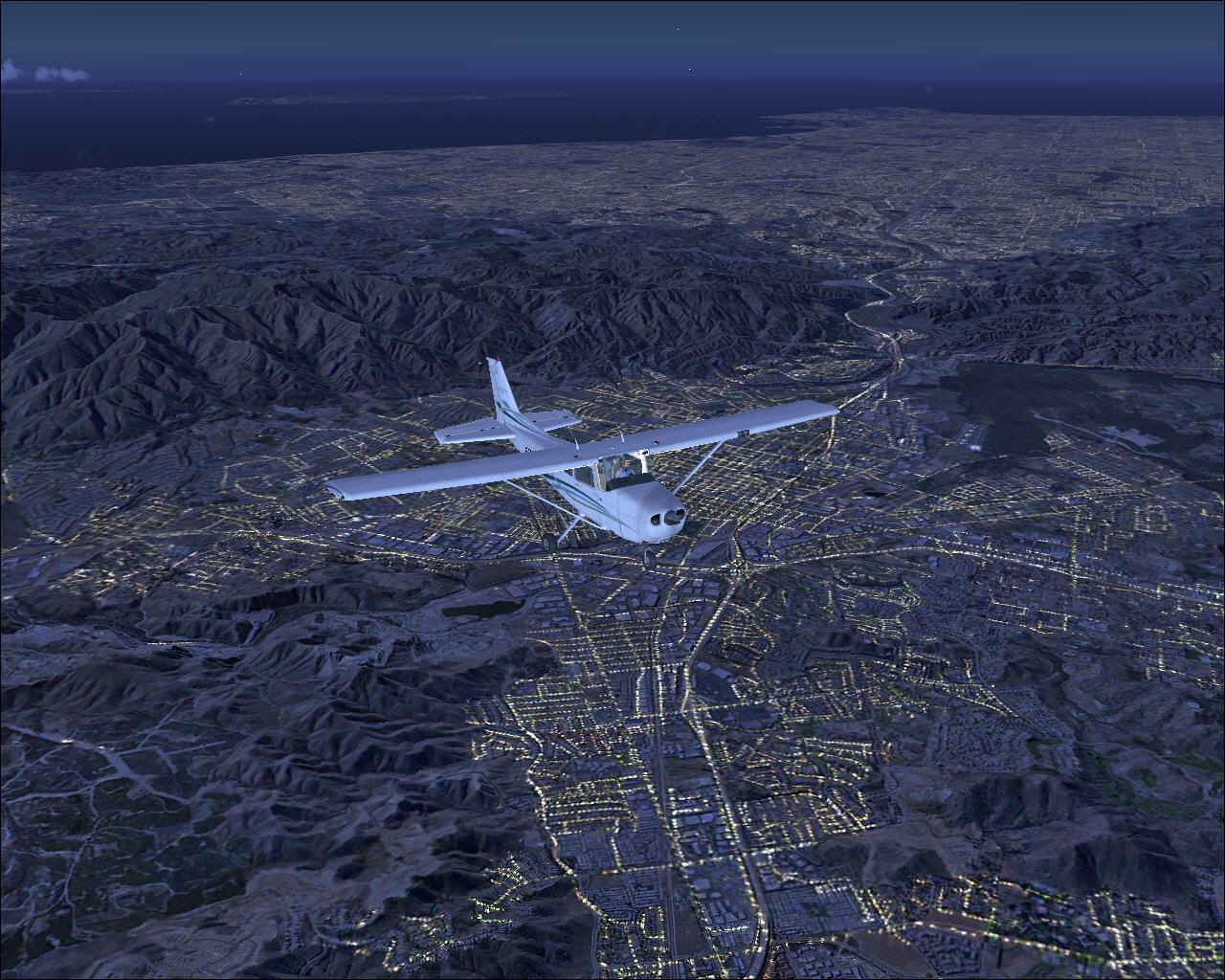
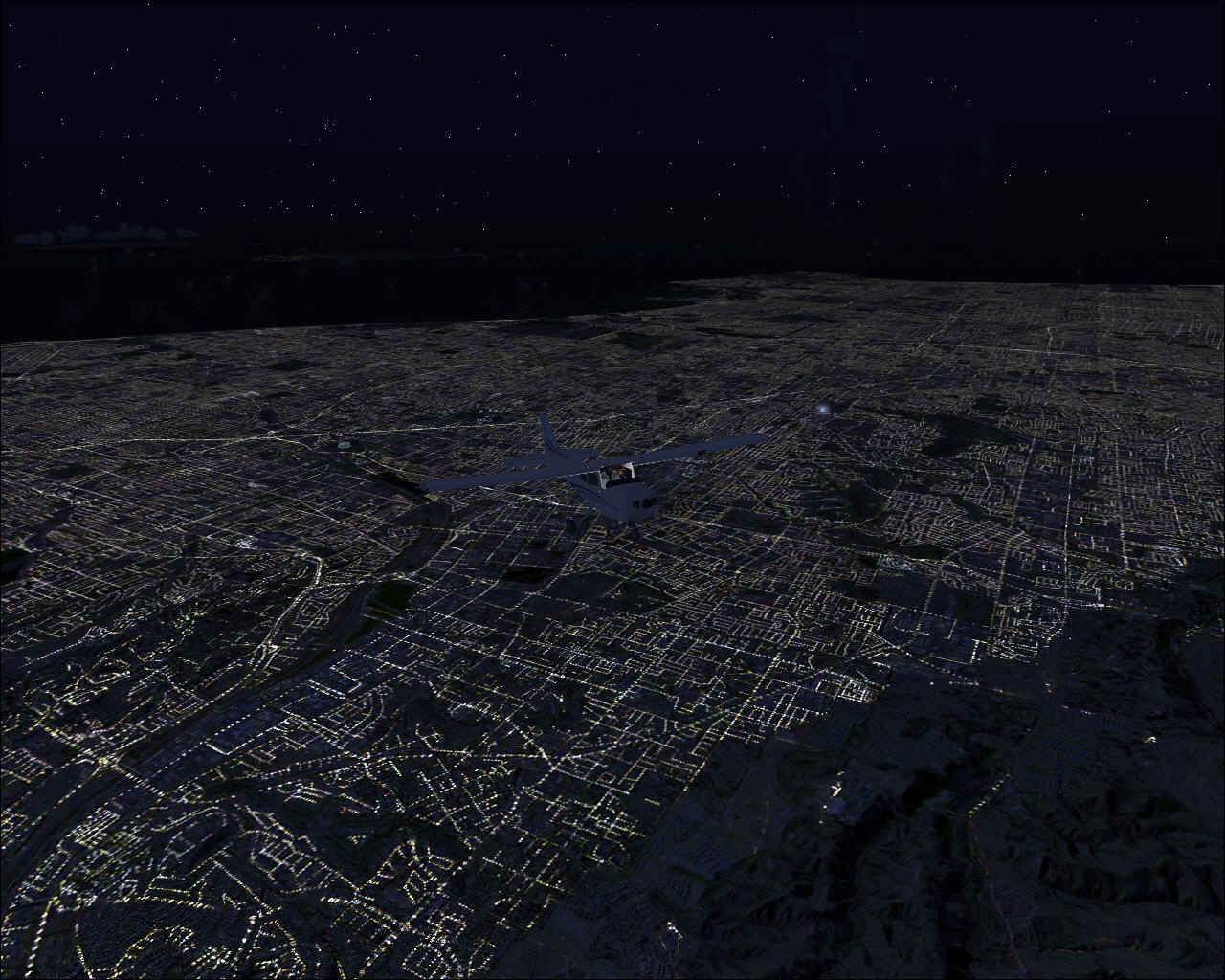
2. Spine Tingling NIGHT Scenery - MegaScenery's UNIQUE proprietary NightScene™ Night Scenery mapping technology recreates the entire scenery area again at night. No... it's not just random lights - MegaScenery knows where every light emitting source in the area covered is right down to the street level. No other product gives you such a realistic night flying experience. The only way to describe the effect is "spine-tingling". When you're flying over Los Angeles, San Diego or more remote regions for that matter - it looks just like it would at night in real life as streets, subdivisions and even interstates light up. You get to truly experience flying Night VFR!
ENJOY HUNDREDS OF HOURS OF FLYING
• 18,000 square miles (135 nm x 135 nm - with the longest points 190 nm apart) of hyper-real day scenery
• 18,000 square miles (135 nm x 135 nm - with the longest points 190 nm apart) of hyper-real night scenery
A total of 36,000 square miles of unique scenery lets you explore this visually spectacular area of the United States. This area will take you months to explore in full - many hundreds of hours of flying over terrain where every square foot of the world moving beneath you is unique and REAL and NOT just repeating default textures... day and night!
MegaSceneryX: Southern California is the most visually spectacular MegaSceneryX yet and yes, you will pinch yourself for a reality check.
PLUS ALL THE CHARTS YOU NEED TO NAVIGATE YOUR WORLD
With MegaSceneryX: Southern California, you're flying over the real world! We believe there's no sense in flying blind. So we've given you all of the actual printed, full size and proper scale, copies of FAA aeronautical maps and charts required to navigate your scenery. You get a complete VFR (and IFR) flying kit. You get the following PRINTED full color FAA maps with your scenery:
• 1 Full Color Los Angeles Terminal Area Chart.
• 1 Full Color San Diego Terminal Area Chart.
• 150 instrument approach charts and Airport Diagrams in a bound printed manual.
• Additional printable PDF supplement of 84 SIDS & STARS for the Southern California Area.
MEGASCENERYX - SOUTHERN CALIFORNIA IS THE CLEAREST, CRISPEST, MOST VISUALLY SPECTACULAR SCENERY TITLE YET AND INCLUDES ALL THE LATEST MEGASCENERY TECHNOLOGY DEVELOPMENTS:
• 1 foot per pixel source data from Aerial photos.
• Displays in FSX at 1.19 meters per pixel. 16 times the resolution as previous
• Faster framerates than default FSX scenery
• Improved Night Scenery
• High resolution 10 meter terrain elevation mesh. Mountains have never looked so real!
• Repositioning of incorrectly placed default FSX objects
• Hand-aligned airports for seamless integration with the photoscenery
• New improved autogen.
• Many other tweaks and fine enhancements
• Delivered to you on DVD Media (4 DVD's) for installation ease and convenience
Say Goodbye To Default Flight Simulator Scenery Forever - Your Flight Simulator world will NEVER look the same again!
Stop for a moment to imagine the scenery world you’ve always dreamed of flying with Microsoft Flight Simulator…. MegaSceneryX: Southern California is that scenery!
Box Contents:
-
MegaSceneryX Southern California DVD's
-
Installation & Technical Manual
-
150+ instrument approach charts and airport diagrams in bound printed manual.
-
1 Full Color Los Angeles Terminal Area Chart
-
1 Full Color San Diego Terminal Area Chart
-
Supplemental printable PDF manual with 84 SIDS and STARS.
-
Weight 1.0 Pounds
|
|