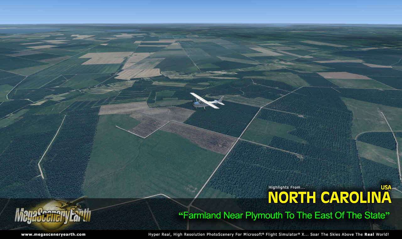
What could be more fitting for any flight simmer wanting to fly a photoreal world than the state that brought us flight. At over 53, 818 square miles North Carolina is a massive and geographically diverse state that lets you experience all kinds of terrain, from challenging mountain flying in the Smoky Mountains to large expanses of flat yet detailed farmland. On top of that you get an Atlantic coastal flying experience as you navigate the outer banks and the Atlantic coast to the east of the state.
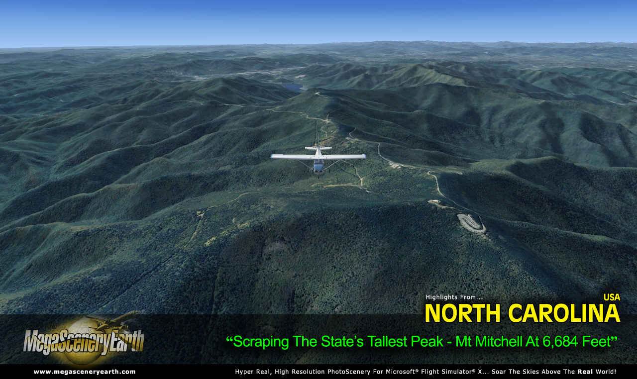
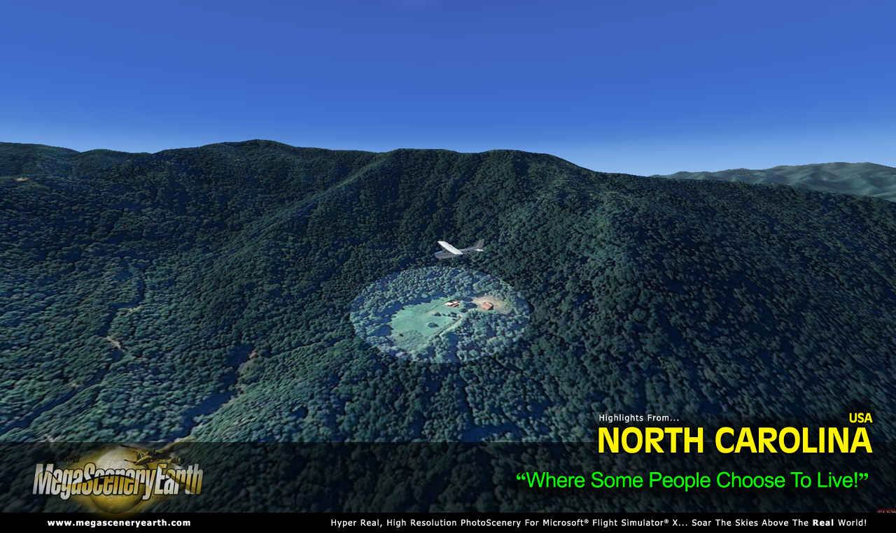
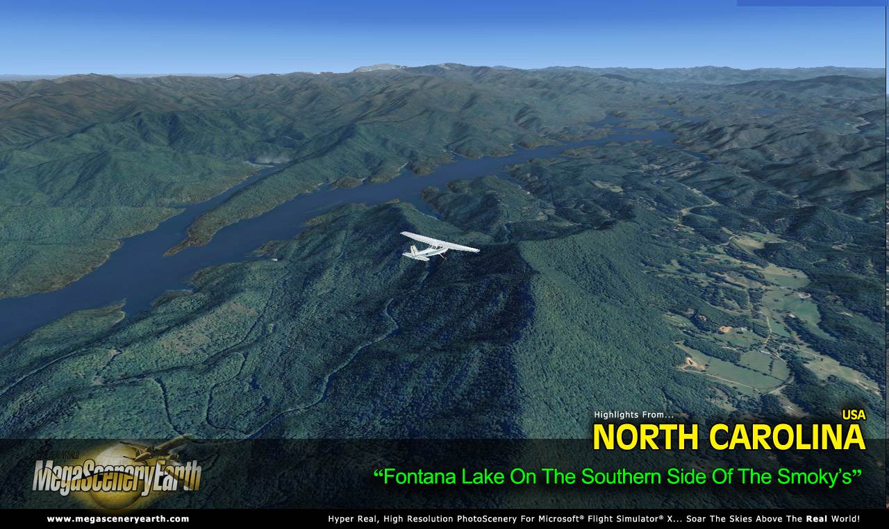
While neighboring state, Tennessee has the general perception of being home to the Smoky Mountains, the southern side of the Smokys is in North Carolina and as a result it’s in the scenery to give you stunning, high res mountain scenery that lets you get right down in those valleys as well as soaring over peaks. The highest point is Mt Mitchell at 6,684 feet (see screenshot below).
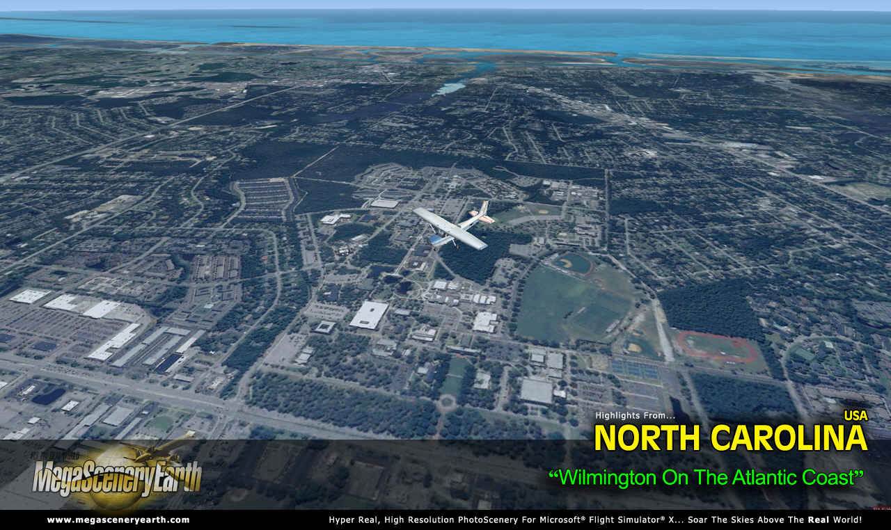
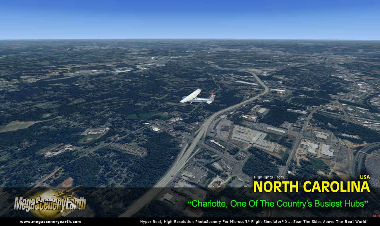
As well as the diverse land forms, you get to flying into some well known cities such as Charlotte, which is one of the country’s busiest hubs and the progressive modern twin cities of Raleigh-Durham – all, of course recreated in stunning high detail from 50 cm resolution imagery.
There are over 334 airports for you to use as landing and departure points as you enjoy the scenery. The large size of this state enables you to enjoy flights of up to 500 miles from east to west. There’s many, many hours of flying to be done as you enjoy the eye candy of North Carolina.
Some of the cities and landmarks you'll get to enjoy as you explore North Carolina include:
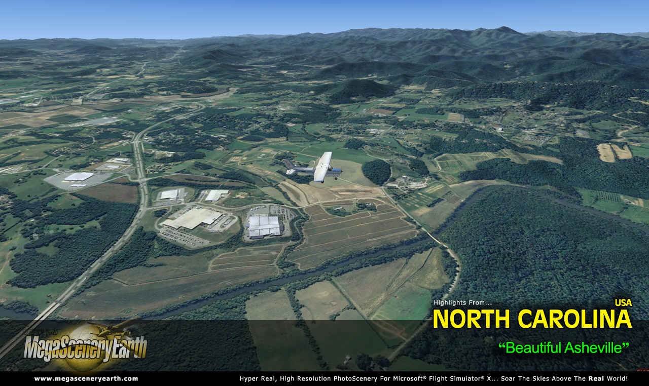
Cities: Charlotte, Raleigh, Greensboro, Winston-Salem, Durham, Fayetteville, Cary, Wilmington, Greenville, Asheville.
Lakes: Norman, Fontana, Hearon, Gaston, B. Everett Jordan, High Rock, Falls Lake, Hickory, james/Rhodhiss
Mountains: Mt Mitchell (6,684 ft), Mt Craig (6,637 ft), Mt Guyot (6,614 ft), Balsam Cone (6,585 ft), Blue Ridge (6,581 ft), Mt Buckley (6,568 ft) and a total of 50 mountains above 6,000 feet.
State Parks: Stone Mountain, South Mountains, Raven Rock, Lumber River, Chimney Rock, Hanging Rock, Gorges, Crowders Mountain amongst many others.
Major Rivers: Cape Fear, Catawba, Neuse, New, Roanoke, French Broad, Yadkin Pee-Dee.
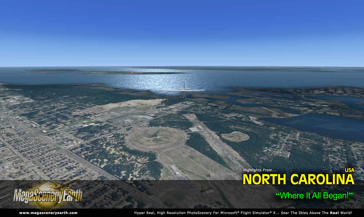
Some Other Major Landmarks & Highlights: Outer Banks, Kill Devil Hills (Kittyhawk), Blue Ridge Mountains & Parkway, Cherokee Indian Reservation, Atlantic Coastline.
Discover the rest of it all for yourself!
As an added bonus, we now provide all the VFR and IFR charts in digital PDF format to enable you to get the most out of your scenery. This includes TACs and Sectionals, IFR enroute charts and 525 page book of Instrument Approach plates, Airport Diagrams, SIDs and STARs. The charts are downloadable along with your scenery files.
This is a download edition with the option to order a DVD disk set (6 discs).
When you order the DVD disk set you will still receive download links. If you do not wish to download, simply wait for your DVDs to arrive in the mail.
THIS TITLE COMES WITH A FULL SET OF FAA AERONAUTICAL CHARTS FOR NORTH CAROLINA IN PDF FORMAT.
Here's what you get (download links for charts will be given to you with your product download):
SECTIONAL CHARTS: Charlotte, Washington, Atlanta and Cincinnati
TERMINAL AREA CHARTS: Charlotte
LOW ALTITUDE IFR CHARTS: ELUS-25/ELUS-26 and ELUS-35/ELUS-36
HIGH ALTITUDE IFR CHARTS: EHUS-9/EHUS-10
AIRPORT FACILITY DIRECTORY: A 60 PAGE PDF BOOKLET
APPROACH CHARTS & AIRPORT DIAGRAMS: A 525 PAGE PDF BOOKLET
An important thing to note with MegaScenery is that with MegaScenery, framerates are faster than the default artificial scenery. So not only do you get the ultimate in realism but you also get a smoother flying experience.
If you don't like to download, choose the DVD MASTER Option and we'll master a 6 disc DVD set with the software and mail it to you anywhere in the world for just $12.00 - all inclusive. Please note that this is a large download at 23.0 Gb. If you are unsure of the stability of your connection we highly recommend you order the DVD Master Option and you'll receive this area on 6 DVDs.
NOTE: You will download a small zip file that has a html file with links to the 21 files that you will download.
You can find out more about MegaSceneryEarth Here
SYSTEM REQUIREMENTS
-
Microsoft Flight Simulator X, FSX: STEAM EDITION, Prepar3D Version 1, Prepar3D Version 2 or Prepar3D Version 3
-
Any system capable of running FSX
-
23.0 Gb Hard Drive Space
DOWNLOAD SIZE
-
23.0 Gb -
Download Time
50 MBps About 60 Mins
20 MBps About 3 Hours
10 MBps About 5.5 Hours
5 MBps About 11 Hours
-
NOTE: You will download a small zip file that has a html file with links to the 21 files that you will download.
-
You can install and fly the first while others are downloading. Each file takes around 10 to 30 minutes to download with a broadband connection.
-
If you're not confident with the large download you can order the DVD Master for just $12. (6 DVDs).
GET FREE DOWNLOADABLE OFFICIAL AERONAUTICAL CHARTS FOR NORTH CAROLINA HERE:
Clicking on the links will take you to the respective download page at the faa.gov website
SECTIONAL CHARTS: Charlotte, Washington, Atlanta and Cincinnati (CLICK HERE)
TERMINAL AREA CHARTS: Charlotte (CLICK HERE)
LOW ALTITUDE IFR CHARTS: ELUS-25/ELUS-26 and ELUS-35/ELUS-36 (CLICK HERE)
HIGH ALTITUDE IFR CHARTS: EHUS-9/EHUS-10 (CLICK HERE)
AIRPORT FACILITY DIRECTORY (CLICK HERE)
APPROACH CHARTS & AIRPORT DIAGRAMS (CLICK HERE)
|