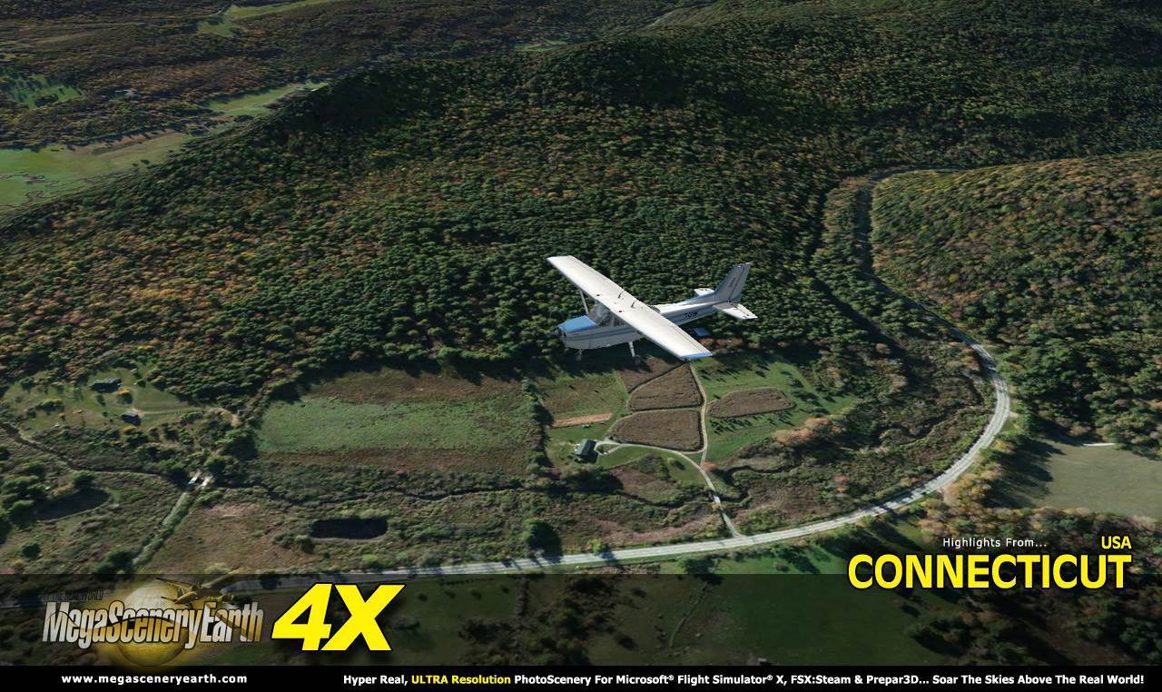
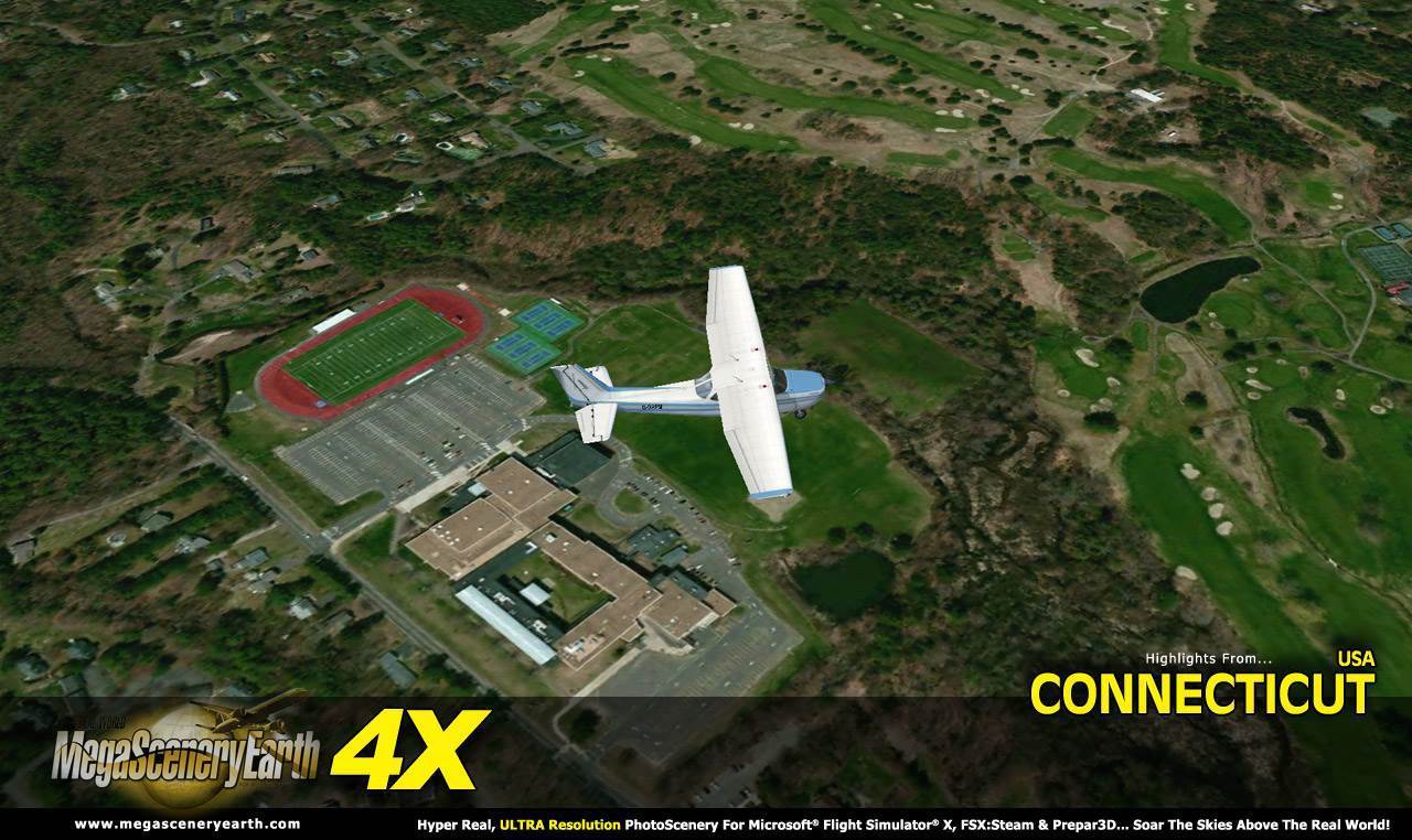
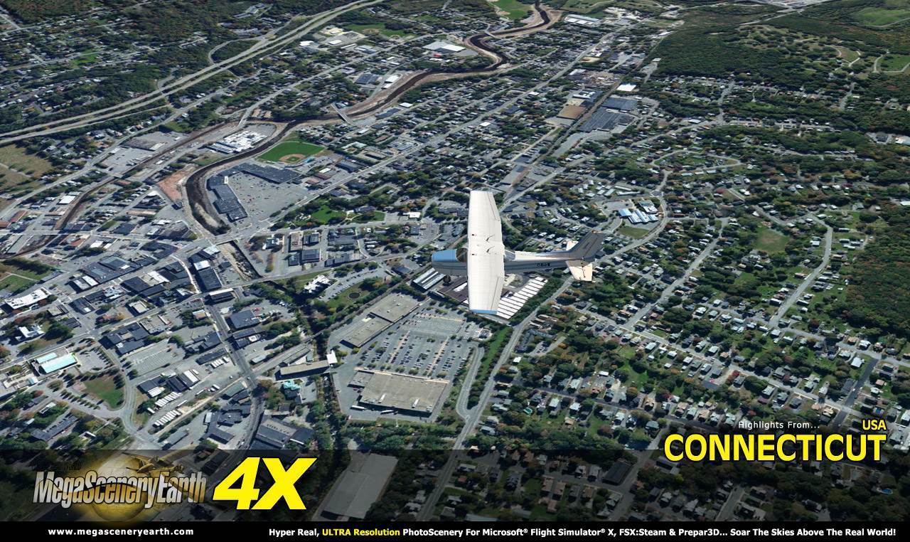
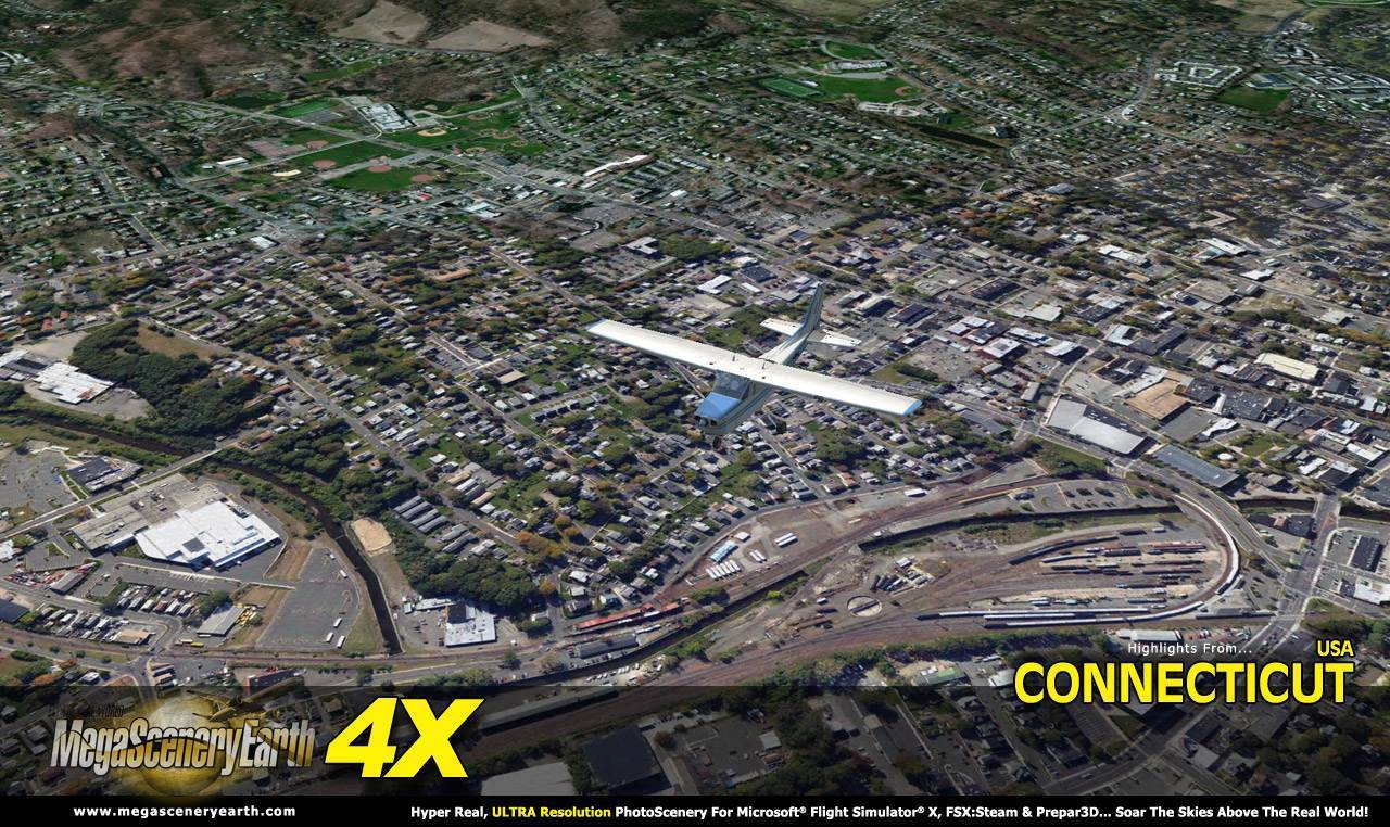
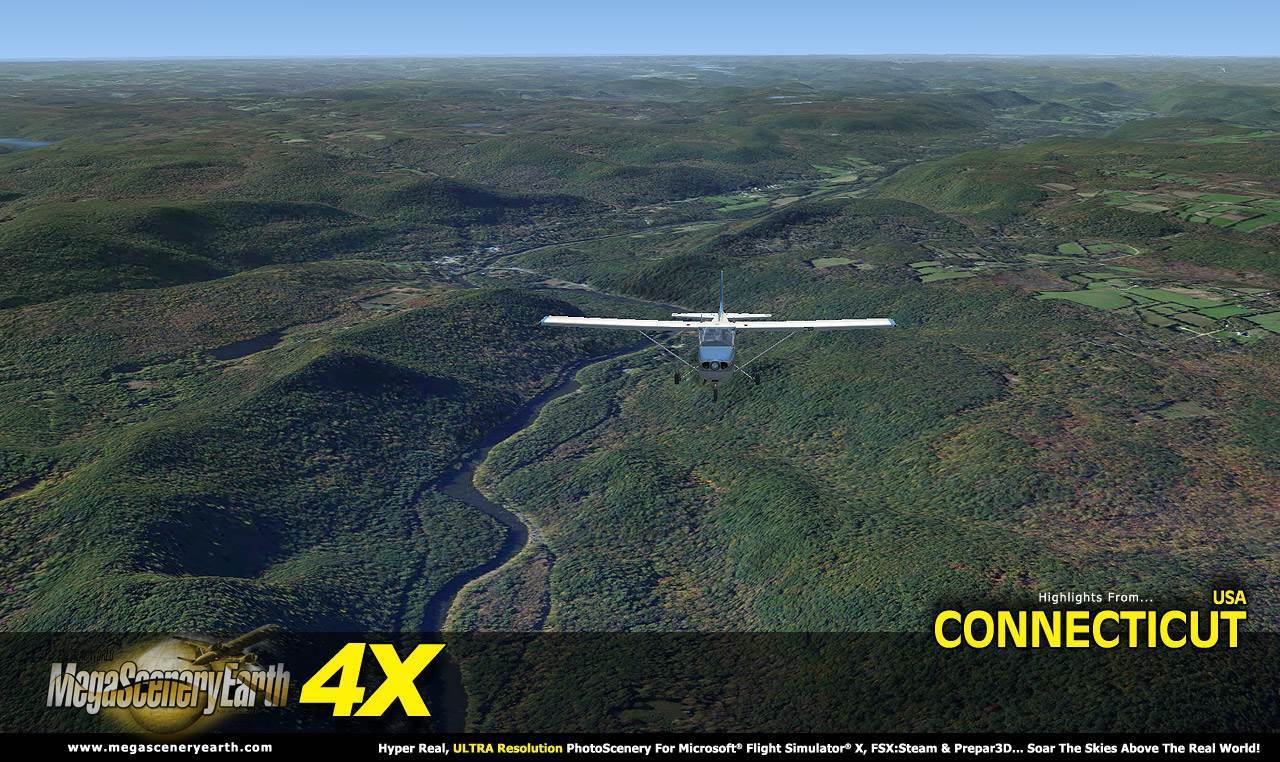
Now you get to fly the entire state of Connecticut in ultra-res photoreal detail with MegaSceneryEarth 4X - Connecticut!
Connecticut is 5,544 square miles in size and has 64 airports. You'll see everything that you see in Connecticut in real life in the scenery.
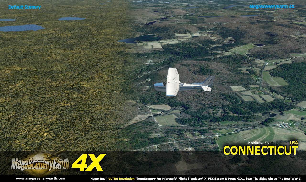
New 4X technology displays at 50 cm per pixel - 4 times the resolution of the previous version 2.0.
As an added bonus, we provide all the VFR and IFR charts in digital PDF format to enable you to get the most out of your scenery. This includes TACs and Sectionals, IFR enroute charts and 108 page book of Instrument Approach plates, Airport Diagrams, SIDs and STARs. The charts are downloadable along with your scenery files.
Some of the cities and landmarks you'll get to enjoy as you explore Connecticut include:
Cities: Bridgeport, Hartford, New Haven, Stamford, Waterbury, Norwalk, Danbury
Lakes: Candlewood, Lilliononah, Bantam, Zoar, Waramaug, East Twin Lake, Highland
Mountains & Hills: Bear Mountain (2,323 ft), Round Mountain, Bald Peak, Mount Riga, Lions Head, The Pinnacle
State Parks & National Forests: Housatonic, Algonquin, Peoples, Nepaug, Nipmuck, Natchaug, Cockaponset
Major Rivers: Connecticut River, Housatonic, Thames
Discover the rest of it all for yourself! There's a LOT to see!
This is a download edition with the option to order on DVD. (2 discs).
When you order the DVD disk set you will still receive download links. If you do not wish to download, simply wait for your DVDs to arrive in the mail.
THIS TITLE COMES WITH A FULL SET OF FAA AERONAUTICAL CHARTS FOR CONNECTICUT IN PDF FORMAT.
Here's what you get (download links for charts will be given to you with your product download):
SECTIONAL CHARTS: New York
LOW ALTITUDE IFR CHARTS: ELUS-33/ELUS-34
HIGH ALTITUDE IFR CHARTS: EHUS-11/EHUS-12
AIRPORT FACILITY DIRECTORY: A 12 PAGE PDF BOOKLET
APPROACH CHARTS & AIRPORT DIAGRAMS: A 108 PAGE PDF BOOKLET
An important thing to note with MegaScenery is that with MegaScenery, framerates are faster than the default artificial scenery. So not only do you get the ultimate in realism but you also get a smoother flying experience.
If you don't like to download, choose the DVD MASTER Option and we'll master a 2 disc DVD set with the software and mail it to you anywhere in the world for just $5.00 - all inclusive. Please note that this is a large download at 4.94 Gb. If you are unsure of the stability of your connection we highly recommend you order the DVD Master Option and you'll receive this area on 2 DVDs.
NOTE: You will download a small zip file that has a html file with links to the 3 files that you will download.
You can find out more about MegaSceneryEarth Here
SYSTEM REQUIREMENTS
-
Microsoft Flight Simulator X or FSX: STEAM EDITION or Prepar3D Version 1 or Prepar3D Version 2 or Prepar3D Version 3
-
Any system capable of running FSX
-
4.94 Gb Hard Drive Space
DOWNLOAD SIZE
-
4.94 Gb -
Download Time
50 MBps About 20 mins
20 MBps About 50 mins
10 MBps About 100 mins
5 MBps About 200 mins
-
NOTE: You will download a small zip file that has a html file with links to the 3 files that you will download.
-
You can install and fly the first while others are downloading. Each file takes around 10 to 30 minutes to download with a broadband connection.
-
If you're not confident with the large download you can order the DVD Master for just $5. (2 DVDs).
|