This is the state that Californians and non-Californians alike have been waiting for!
Because of its huge size, we have divided California into 4 sections.
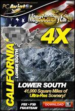
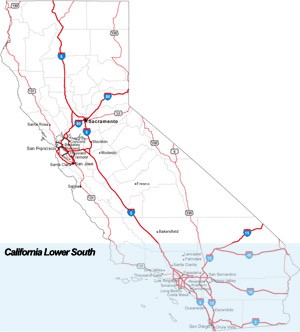
This particular page title is California Lower South and is approximately 41,000 square miles.
The text below describes the complete state of California, this particular page is for ordering California Lower South only. The image on the right shows the area covered. This section includes Los Angeles and San Diego.
This is a download edition with the option to order a DVD disk set (8 discs).
These links take you to ordering & information pages for the 4 subsections of California if you wanted to order a smaller area at a time.
If you own V2.0 of this state, you can upgrade to this 4X version for 50% discount. Please contact [email protected] for an upgrade code. |
Fly the entire state - BORDER to BORDER - of California in photoreal detail.
The third largest state in the USA, California is massive at over 163,695 square miles in size and has 600 airports.
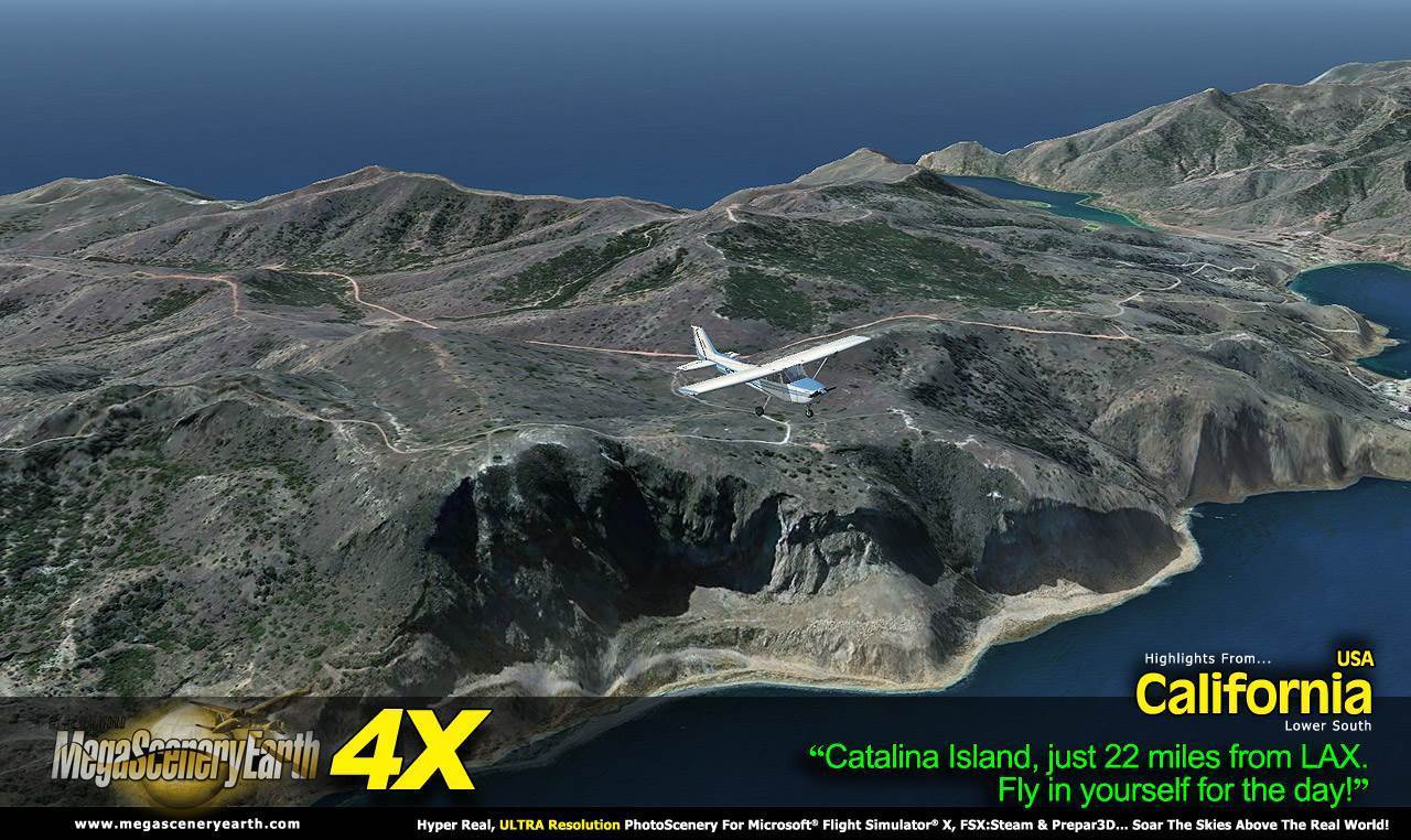
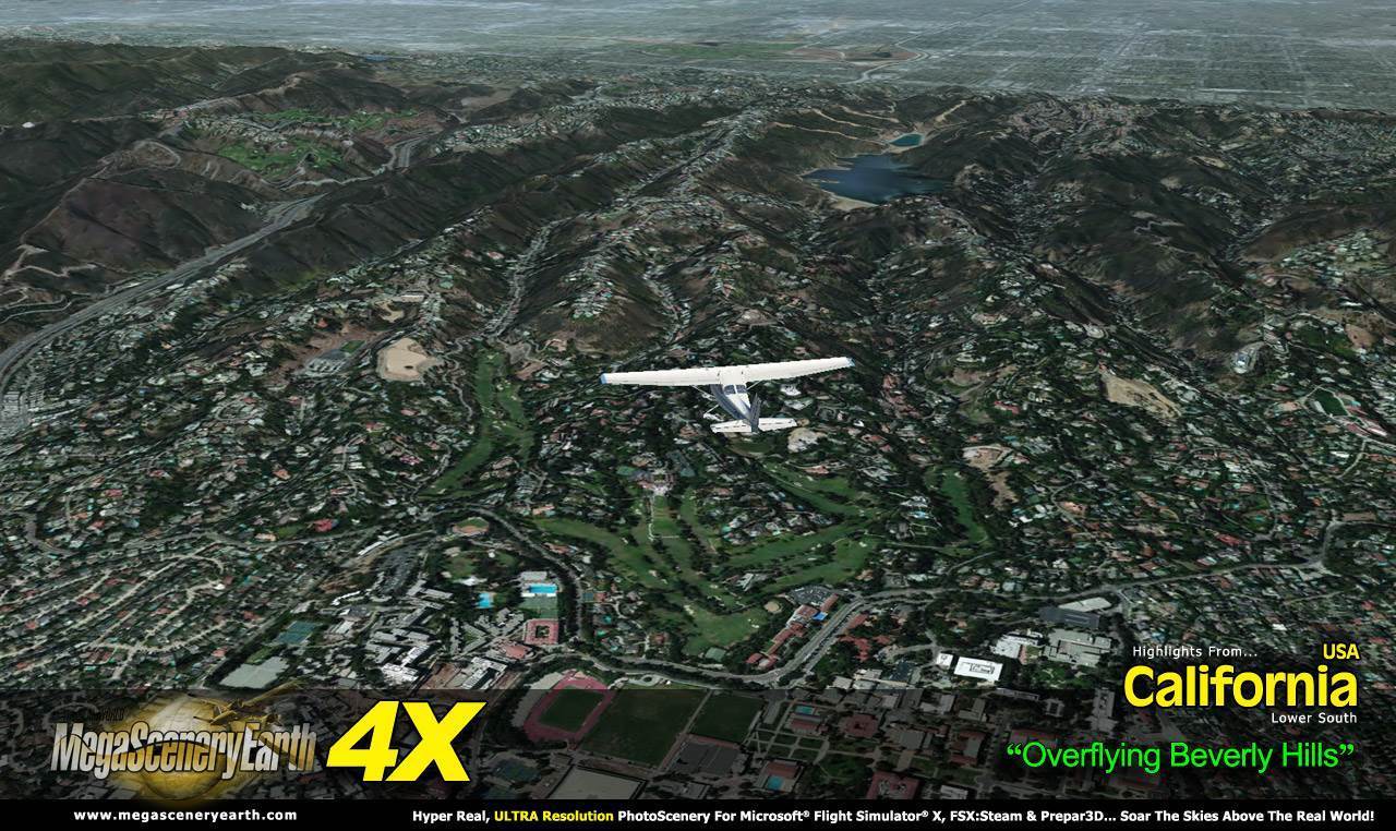
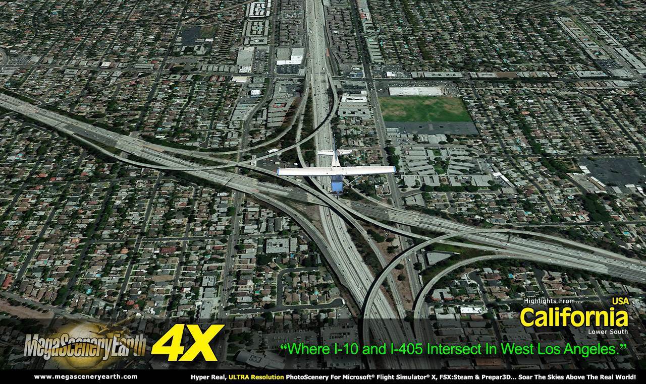
New 4X technology displays at 50 cm per pixel - 4 times the resolution of the previous version 2.0.
You'll see everything that you see in California in real life in the scenery. Imagery is clear and crisp 50 cm source throughout for a stunningly realistic scenery.
As an added bonus, we now provide all the VFR and IFR charts in digital PDF format to enable you to get the most out of your scenery. This includes 5 Sectionals, 3 Terminal Area Charts, 7 IFR enroute charts, 3 VFR Flyways Planning Charts and a 1046 page book of Instrument Approach plates, Airport Diagrams, SIDs and STARs, and an Airport Facility Directory. The charts are downloadable along with your scenery files.
Some of the cities and landmarks you'll get to enjoy as you explore California include:
Cities: Los Angeles, San Diego, San Francisco, San Jose, Fresno, Sacramento, Oakland, Santa Ana, Anaheim, Stockton, Palm Springs
Lakes & Water Bodies: Lake Tahoe, Salton Sea, Owens Lake, Searles Lake, 840 miles of Pacific Ocean coastline
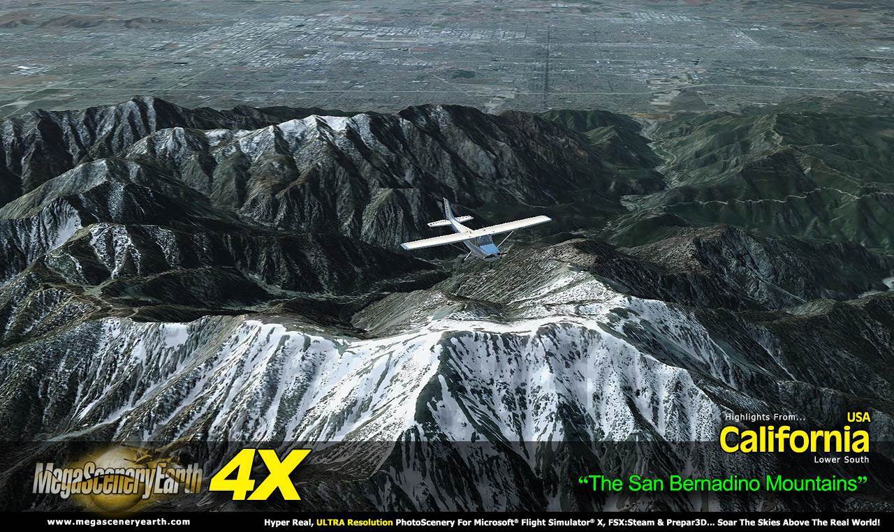
Mountains & Hills: Mt Whitney (14,452 ft), Sierra Nevada, Mount Williamson, White Mountain Peak, Crooks Peak, Mount Shasta, Mount Russell, Split Mountain and a total of 50 peaks above 13,500 ft.
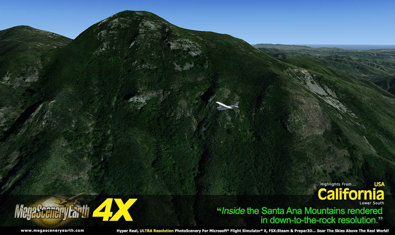
State Parks & National Forests: Angeles National Forest, Cleveland National Forest, Eldorado National Forest, Inyo National Forest, Klamath National Forest, Lake Tahoe Basin Management Area, Lassen National Forest, Los Padres National Forest, Mendocino National Forest, Modoc National Forest, Plumas National Forest, San Bernardino National Forest, Sequoia National Forest, Shasta-Trinity National Forest, Sierra National Forest, Six Rivers National Forest, Stanislaus National Forest, Tahoe National Forest
Major Rivers: Sacramento River, San Joaquin River, Colorado River
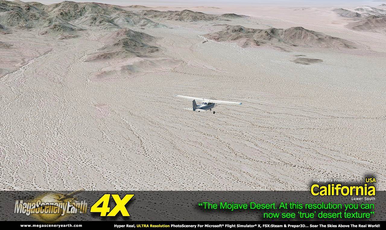
Deserts: Mojave, Colorado, Great Basin
Islands: San Clemente, Catalina, Santa Cruz, Santa Rosa, San Miguel, Satna Barbara, San Nicholas
Discover the rest of it all for yourself! There's a LOT to see in this massive state!
When you order the DVD disk set you will still receive download links. If you do not wish to download, simply wait for your DVDs to arrive in the mail.
THIS TITLE COMES WITH A FULL SET OF FAA AERONAUTICAL CHARTS FOR California IN PDF FORMAT.
Here's what you get (download links for charts will be given to you with your product download):
SECTIONAL CHARTS: Klamath Falls, Las Vegas, Los Angeles, Phoenix, San Francisco
TERMINAL AREA CHARTS: Los Angeles, San Diego, San Francisco
VFR FLYWAYS PLANNING CHARTS: Los Angeles, San Diego, San Francisco
LOW ALTITUDE IFR CHARTS: ELUS-01/ELUS-02, ELUS-03/ELUS-04, ELUS-05/ELUS-06, ELUS-07/ELUS-08, ELUS-09/ELUS-10, ELUS-11/ELUS-12
HIGH ALTITUDE IFR CHARTS: EHUS-03/EHUS-04
AIRPORT FACILITY DIRECTORY: A FULLY INDEXED 150 PAGE PDF BOOKLET
APPROACH CHARTS & AIRPORT DIAGRAMS: A FULLY INDEXED 1046 PAGE PDF BOOKLET
An important thing to note with MegaScenery is that with MegaScenery, framerates are faster than the default artificial scenery. So not only do you get the ultimate in realism but you also get a smoother flying experience.
If you don't like to download, choose the DVD MASTER Option and we'll master an 8 disc DVD set with the software and mail it to you anywhere in the world for just $16.00 - all inclusive. Please note that this is a large download at 31.2 Gb. If you are unsure of the stability of your connection we highly recommend you order the DVD Master Option and you'll receive this area on 8 DVDs.
NOTE: You will download a small zip file that has a html file with links to the 16 files that you will download.
You can find out more about MegaSceneryEarth Here
SYSTEM REQUIREMENTS
-
Microsoft Flight Simulator X or FSX: STEAM EDITION or Prepar3D Version 1 or Prepar3D Version 2 or Prepar3D Version 3
-
Any system capable of running FSX
-
31.2 Gb Hard Drive Space
DOWNLOAD SIZE
-
31.2 Gb -
Download Time
50 MBps About 1.5 Hrs
20 MBps About 4 Hours
10 MBps About 7.5 Hours
5 MBps About 15 Hours
-
NOTE: You will download a small zip file that has a html file with links to the 16 files that you will download.
-
You can install and fly the first while others are downloading. Each file takes around 10 to 30 minutes to download with a broadband connection.
-
If you're not confident with the large download you can order the DVD Master for just $16. (8 DVDs).
|