Download VFR Real Scenery of Greater London direct to your PC! Fly over the REAL London. The entire area within the M25 (over 1,200 square miles) is available as one great value download. All the features from the rest of the VFR Real Scenery series are included – high resolution images, ‘real’ water and improved night textures. This really is a capital download!
If you want to go sightseeing there are plenty of airports around London within the VFR Real Scenery London area that you can choose as a starting point: London Heathrow, London City, Biggin Hill, Denham, Northolt, Leavsden, Hatfield, Elstree, Fairoaks and Stapleford.
This scenery area is part of the Volume 1 (South-East England).
Just Flight's VFR Real Scenery uses the very latest digital aerial images of the UK to transform Flight Simulator X into the real landscape you can see from the air. With brilliant resolution, night lighting and water effects, this scenery really is as real as it gets!
VFR stands for ‘Visual Flight Rules’ - this is the way that pilots navigate when they aren’t using complex instruments – they look at a map and then pinpoint landmarks on the ground to work out their course and position. It’s the most common form of recreational flying undertaken in the UK, but to do this in a flight simulator requires scenery that’s exactly the same as the real landscape.
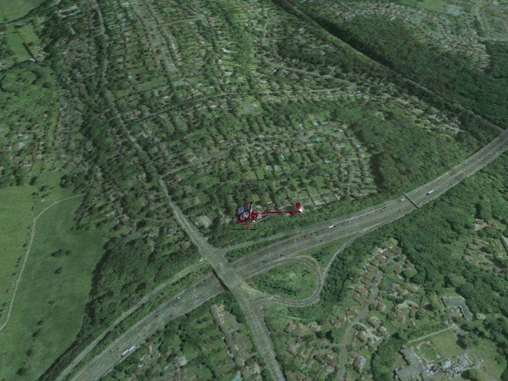
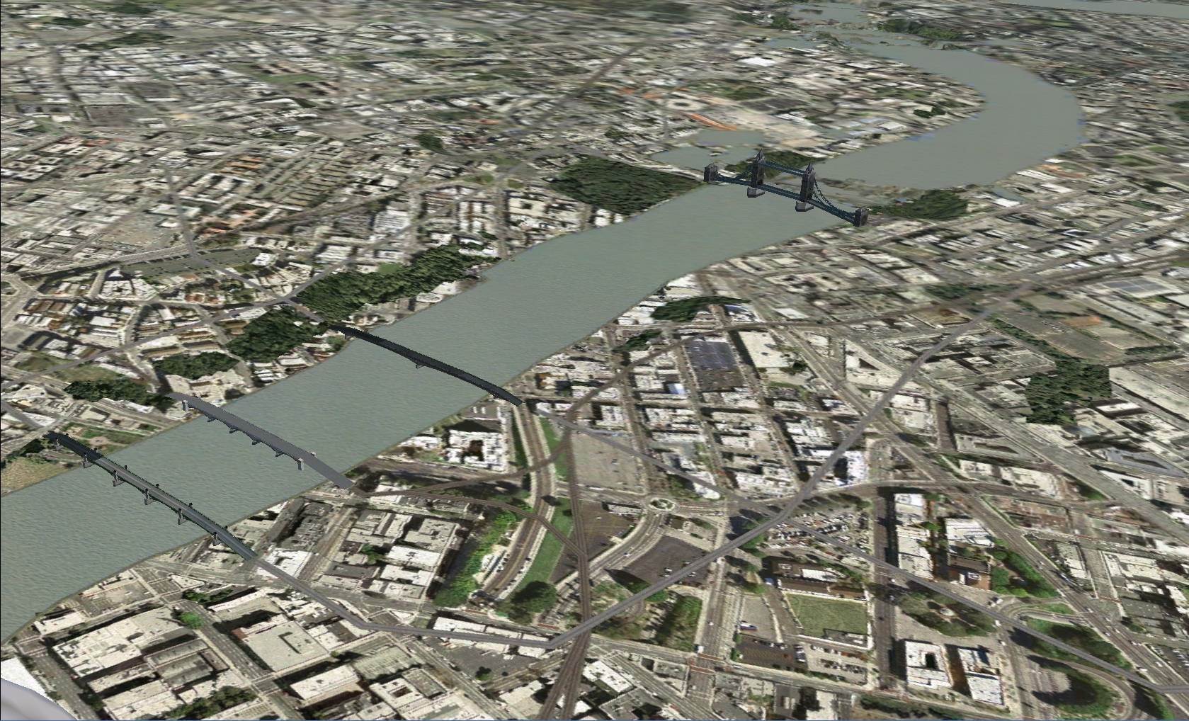
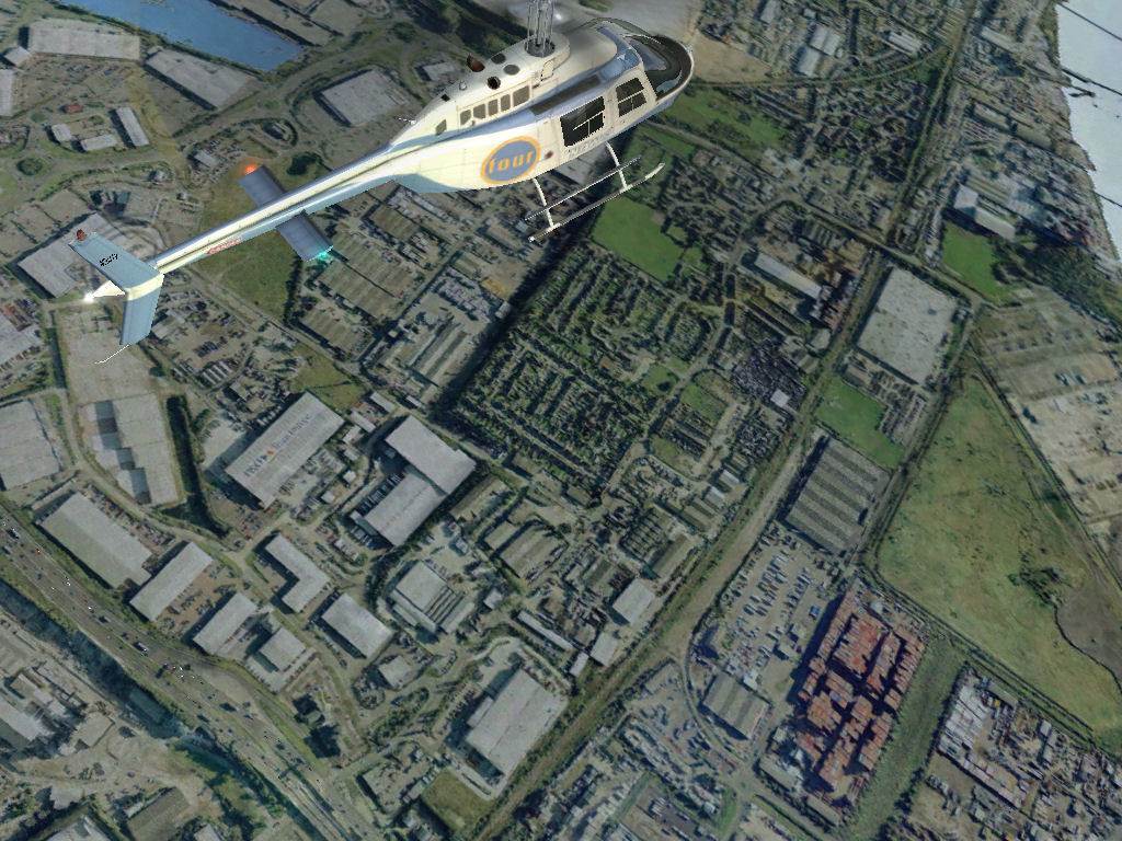
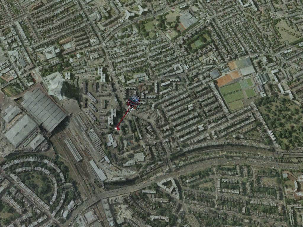
VFR Real Scenery is an amazing piece of software that provides just that - fly over England and Wales in Flight Simulator X and sample the view you’d get from a real aircraft. You can see the real countryside from the air and pinpoint every key landmark. It’s all featured – streets, buildings, rivers, lakes, reservoirs… and all at extremely high resolution and detail!
VFR Real Scenery uses 25cm aerial photographic data of England and Wales to create high resolution scenery optimised for 1m display in Flight Simulator X.
The software includes 9.6m digital terrain data to vastly improve the accuracy of the FSX relief.
Main water features are individually rendered with Flight Simulator water effects. You can land a seaplane on the lakes and rivers in VFR Real Scenery!
Custom night lighting – night effects are applied individually to each part of the scenery for accuracy and realism.
Where are the pictures from?
We’ve teamed with Infoterra Ltd, a leader in the provision of aerial data, for the use of the GeoPerspectives™ countrywide archive. The result is a series of amazing photographic scenery packages for Flight Simulator X. These images are some of the latest available and modern digital photography techniques mean that they look amazing.
What area does this download cover?
All of the London area within the M25 motorway. If you want to go sightseeing there are plenty of airports around London within the VFR Real Scenery London area that you can choose as a starting point; including London Heathrow, London City, Biggin Hill, Stapleford and Denham.
Isn’t this area also in the boxed version of VFR Real Scenery - South East England?
Yes, but lots of customers, especially those based outside the UK, want to improve the scenery of London but don’t really need the whole of South East England. With this download you can get airborne over London straight away.
I’m going to buy the South East England volume. Should I buy this download as well?
The data included is the same as that in the South East England volume but with a generous Just Rewards offer you might be tempted to buy both! Both sceneries will fit seamlessly together if you do buy both.
I don’t want to use the FSX water effects that are included – how do I turn them off so that I just see the photographic images of the water?
Go to the Settings / Display / Scenery menu in Flight Simulator X and turn the Water Effects slider to Low 1.X or None.
As I fly over some areas, especially from high altitudes, I can sometimes see a change in the colour of the landscape. Why is this?
This is a function of how photographic scenery works. The aerial photographs that go to make up the scenery are usually taken between March and September because this is the time of year when aircraft can fly most often and the weather conditions allow photographs to be taken. As a result, when large numbers of images are put together to form areas of scenery you can occasionally see seasonal variations between areas taken at different times of the year. This shows up as a slight change in the general colour of the landscape between one area and another. One way round this is to ‘correct’ all the colours artificially. Unfortunately, this can lead to some very unrealistic hues in the landscape – blue/grey fields and purple rocks! For this reason we have kept the correction levels to an absolute minimum. The trade-off for this is some seasonal variations, but we think that these very occasional changes are preferable to an overall ‘unrealistic’ set of colours.
I've seen stuff about 25cm data, 1m data, 2m data and 1.2m data. What does it all mean? I'm confused.
These values refer to the amount of ground represented by each pixel. To put it simply, if something is being displayed at 1m this means that each individual ‘dot’ in the image represents a 1m square of the ground. In FS2004 the only level available was 4.8m and this meant that something the size of a normal house (say 12m x 20m) could only be shown using 8 dots. Although quite impressive, you couldn’t see all the detail that was in the original images.
Flight Simulator has gone from 4.8m to 1m and now the same house will be shown using 240 dots, allowing much more detail to be seen. Similarly a normal road displayed at 4.8m will only be 2 dots wide and little more than a vague line in the scenery. At 1m the same road will have enough detail to show separate carriageways and even individual cars.
Although the FSX detail settings refer to the various levels as 1m, 2m, 5m and so on, this is in fact just a rounding off of the true internal levels used by the simulator. The actual values are 1.19m (‘1m’), 2.38m (‘2m’), 4.75m (‘5m’) and so on.
So where does the 25cm come in?
When we say ‘25cm data’ we mean that the original digital images are at a resolution of 25cm per pixel. That's pretty accurate! These 25cm images are then optimised to be displayed at 1m per pixel in Flight Simulator X. The higher the original resolution, the better the quality will be when processed to a lower resolution. 1m gives the best compromise between appearance, performance and file size.
What is terrain mesh and elevation data?
The visual scenery you see when flying in Flight Simulator is all built upon a basic framework (a 'mesh') that represents the height of the ground at any point in the world. This provides the three-dimensional relief model of hills, mountains, valleys, cliffs, depressions, plateaux and so forth, upon which all other scenery objects and ground textures are placed. The vast majority of the area of the default relief model of England and Wales in Flight Simulator X is set at 76m between each reference point. This means that there are no relief detail changes between points less than 76m apart. This creates a very "soft" terrain where mountains that should be craggy appear as smooth rounded hills and individual features that fall between the points are lost completely. VFR Real Scenery includes reference points that are just 9.6m apart which provides a far higher resolution than the default. Even small ground features now become visible.
OK, I understand the 'mesh' but I've seen mesh quoted at 9.6m and 10m - what's the difference?
FSX uses a simplified set of values in the scenery settings options. This avoids things becoming confusing and makes it easier for the user to visualise. When adjusting the Mesh Resolution slider in the Scenery options you will see values like 38m, 19m, 10m, 5m, 2m offered. These in fact are the simplified labels given to the real values. If you select the 10m setting then the actual resolution selected will be 9.6m. Mesh described as "10m mesh" is actually 9.6m mesh when used in FSX
I’m impressed with the default road traffic effects in Flight Simulator X. I suppose these won’t work with VFR Real Scenery?
On the contrary! The alignment of the Flight Simulator X roads is spot on and, if you want, you can get the FSX vehicles to drive along the VFR Real Scenery roads. Simply go to the Settings-Display menu and select Traffic. Then adjust the ‘Road vehicles’ slider in the Land and sea Traffic section.
What is the best flying altitude for sight seeing with VFR Real Scenery?
You can fly much lower than in the FS2002/2004 versions of photographic scenery – even down to a few hundred feet and the scenery will still be in focus. However, for the most realistic sight-seeing altitude we recommend 2,500 feet, as this is a similar altitude to that used by real world pilots when flying local cross-country flights.
Is there a manual?
Yes. VFR Real Scenery –London comes with a manual in PDF format that will help you get the best out of this product.
Requirements
-
Flight Simulator X (Acceleration/SP2 compatible)
-
2.5GHz+ PC
-
512Mb RAM
-
128Mb 3D graphics card
-
Windows 8 / 7 / XP / Vista
-
1Gb hard drive space required
|