The New MegaSceneryEarth New Mexico V3 featuring unsurpassed image sharpness, scenery color and clarity, improved scenery features with accurate additional water bodies and topographical data and the latest aerial imagery available taken in 2016.
Fly the entire state - BORDER to BORDER - of New Mexico in photoreal detail.
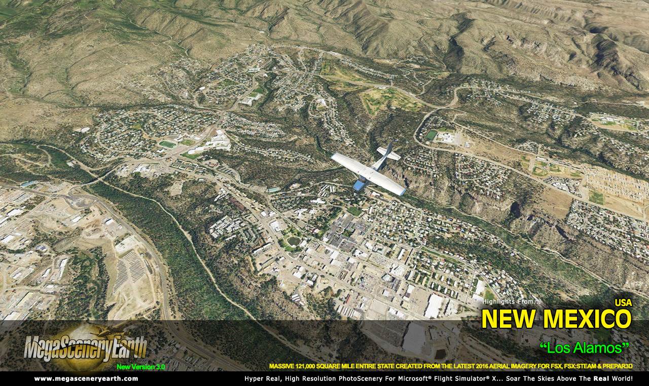
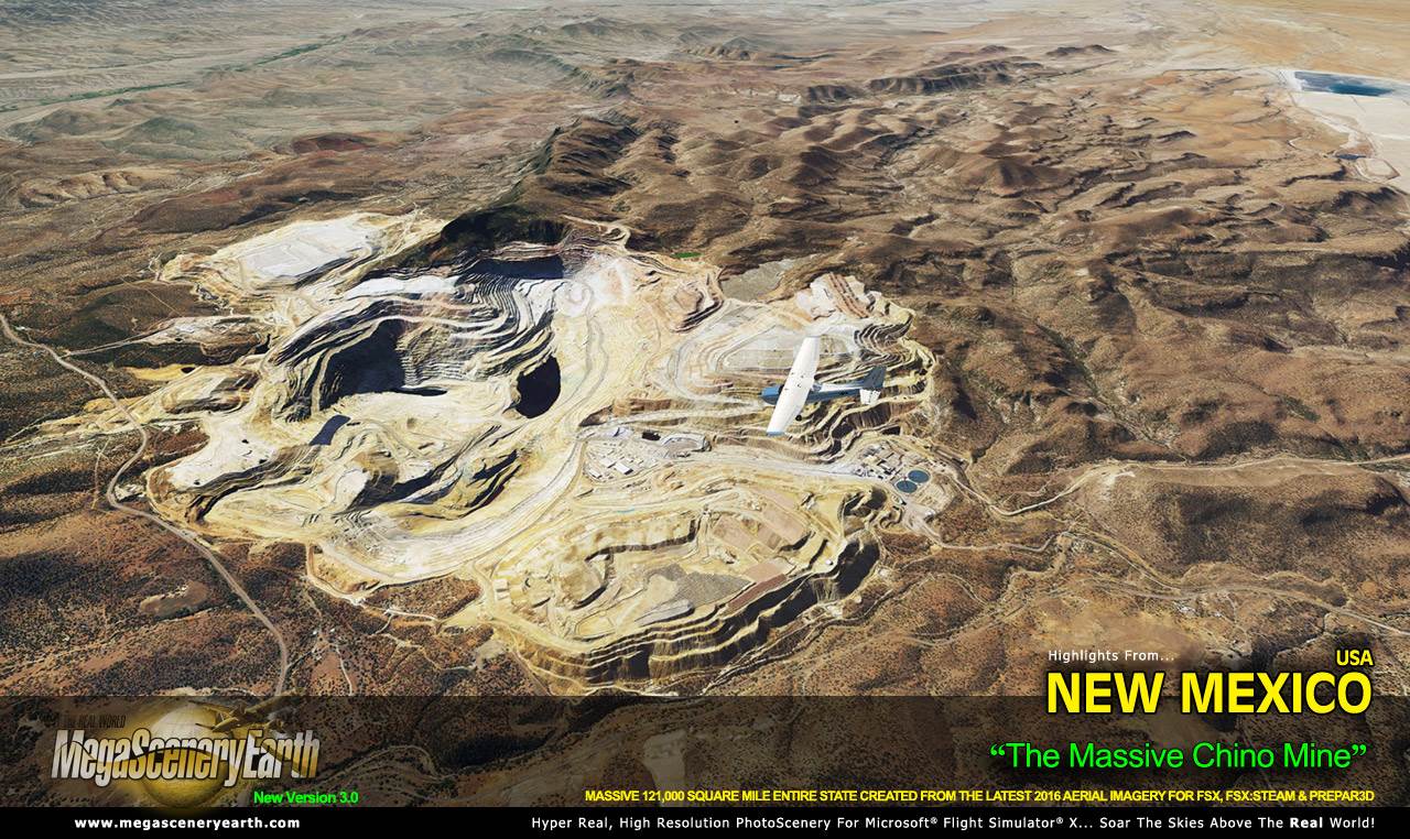
New Mexico is the fourth largest state in the lower 48 at over 121,589 square miles in size and has 158 airports. You'll see everything that you see in New Mexico in real life in the scenery.
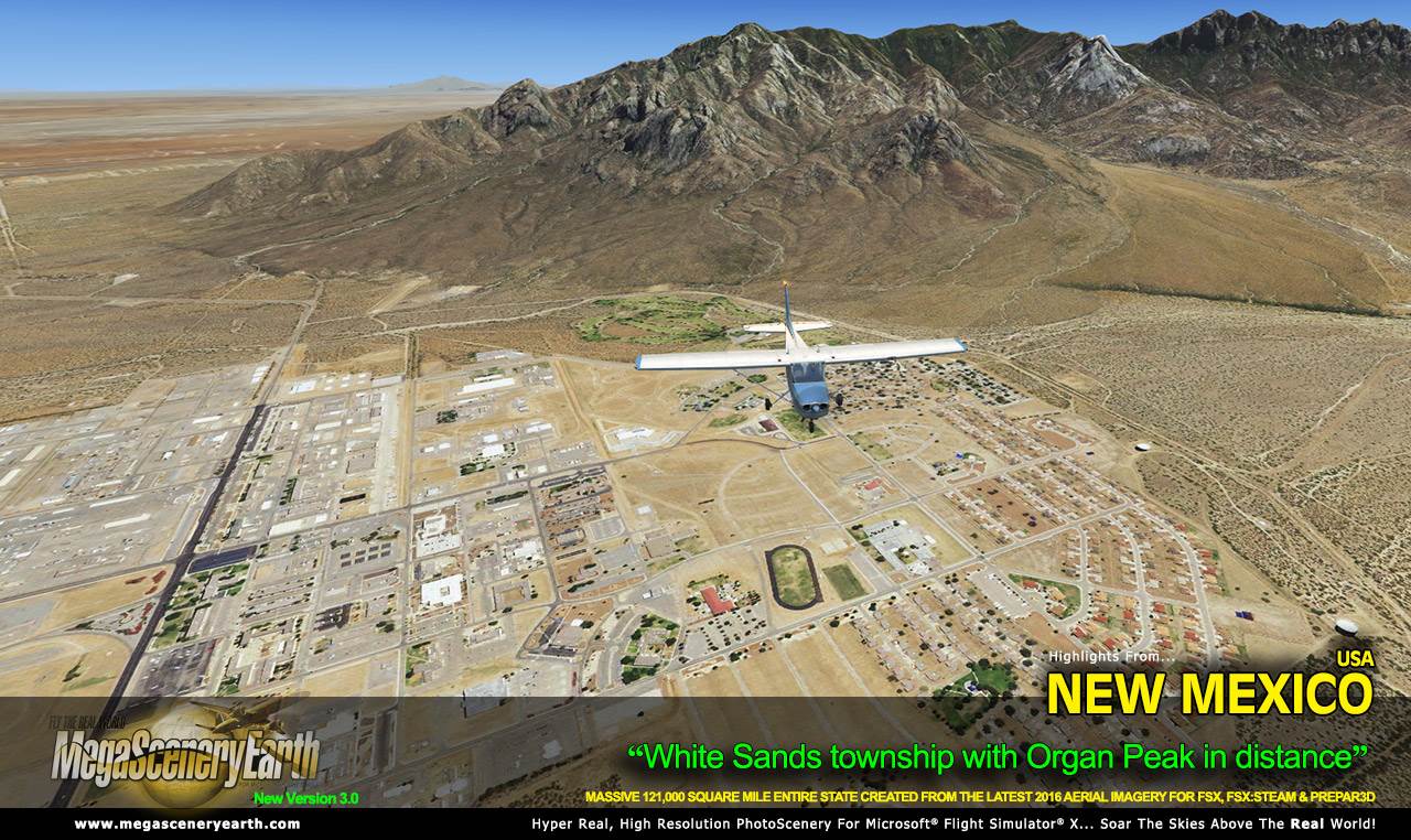
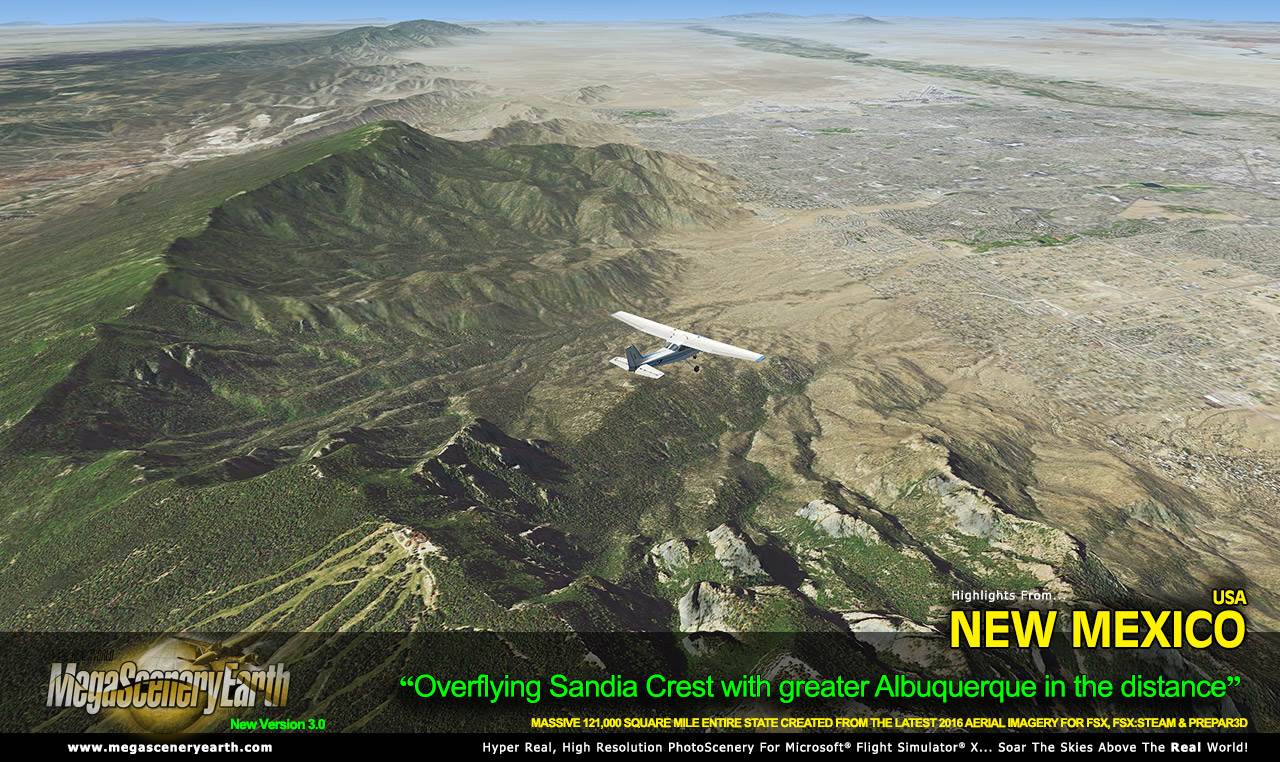
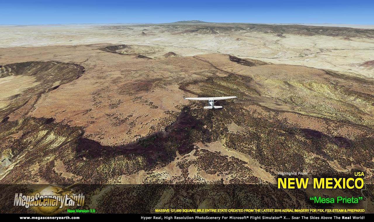
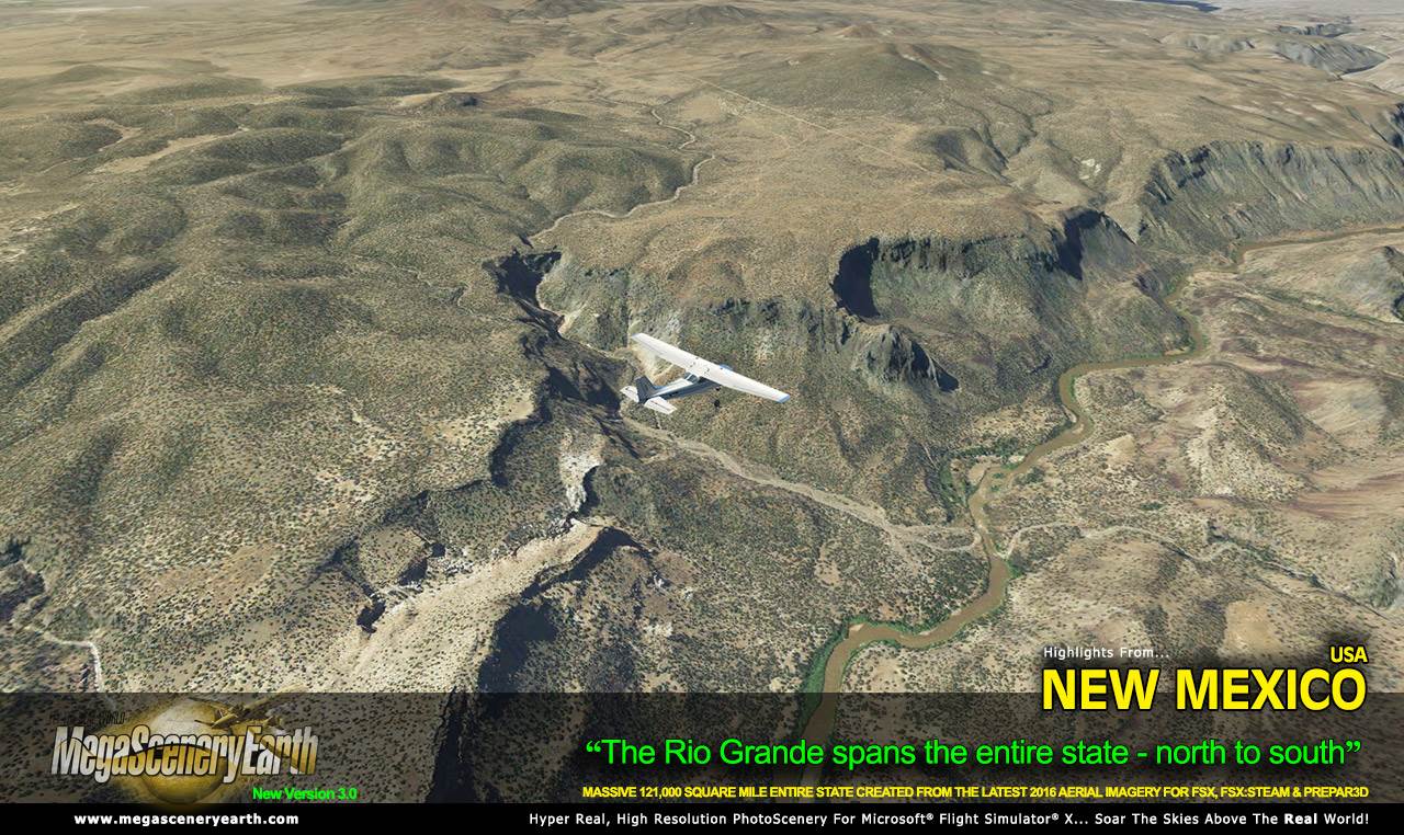
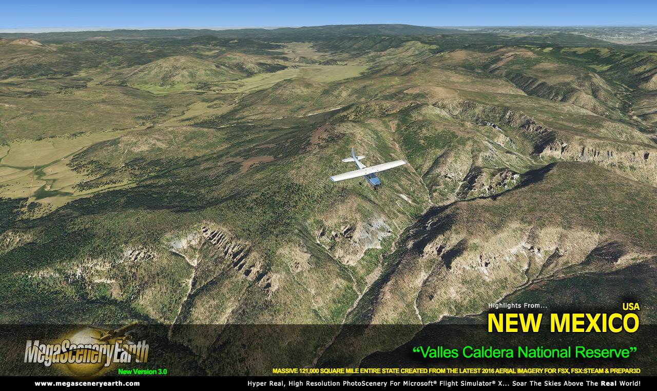
The first of the "mountain states" we are offering in 2.0 format, New Mexico is a visually spectacular and fun place to fly with terrain that varies from towering mountain peaks above 13,000 feet, high plains, canyons, basins, mesas and deserts. This kind of terrain is where MegaSceneryEarth 2.0's high res graphics really shine. You'll be truly stunned by the scenery of New Mexico.
The amount of area covered at the $39.95 price makes it one of the best value per square mile states we offer.
As an added bonus, we now provide all the VFR and IFR charts in digital PDF format to enable you to get the most out of your scenery. This includes two Sectionals, five IFR enroute charts, and a 199 page book of Instrument Approach plates, Airport Diagrams, SIDs and STARs, and an Airport Facility Directory. The charts are downloadable along with your scenery files.
Some of the cities and landmarks you'll get to enjoy as you explore New Mexico include:
Cities: Albuquerque, Las Cruces, Santa Fe, Rio Rancho, Roswell, Alamogordo
Lakes & Water Bodies: Elephant Butte Reservoir, Conchas Lake, Navajo Reservoir
Mountains & Hills: Wheeler Peak (13,163 ft), Mount Walter, Old Mike Peak, Truchas Peak, Simpson Peak, Lake Fork Peak and a total of 50 other peaks and mountains above 11,500 feet.
State Parks & National Forests: Carson National Forest, Cibola National Forest, Gila National Forest, Kiowa National Grassland, Black Kettle & McClellan Creek National Grassslands, Lincoln National Forest, Rita Blanca National Grassland, Santa Fe National Forest
Major Rivers: Rio Grande, Pecos River
Discover the rest of it all for yourself! There's a LOT to see!
This is a download edition with the option to order a DVD disk set (18 discs).
When you order the DVD disk set you will still receive download links. If you do not wish to download, simply wait for your DVDs to arrive in the mail.
THIS TITLE COMES WITH A FULL SET OF FAA AERONAUTICAL CHARTS FOR New Mexico IN PDF FORMAT.
Here's what you get (download links for charts will be given to you with your product download):
SECTIONAL CHARTS: Albuquerque, Denver
LOW ALTITUDE IFR CHARTS: ELUS-05/ELUS-06, ELUS-07/ELUS-08, ELUS-15/ELUS-16
HIGH ALTITUDE IFR CHARTS: EHUS-03/EHUS-04, EHUS-05/EHUS-06
AIRPORT FACILITY DIRECTORY: A FULLY INDEXED 30 PAGE PDF BOOKLET
APPROACH CHARTS & AIRPORT DIAGRAMS: A FULLY INDEXED 199 PAGE PDF BOOKLET
NOTE: The screenshots don't even scratch the surface of the scope and expanse of this scenery. Discover it all yourself when you purchase this scenery.
|