Photo_Aligned_Airports_Texas.zip (2.3 MB)
FREE DOWNLOAD: PhotoAligned Airports For Texas Courtesy Gene Lacy - Datawings
Everything is bigger in Texas and so is its recreation in MegaSceneryEarth! 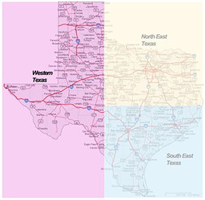
Anything we say doesn't do a photorealistic rendition of scenery for Texas justice. Texas is supermassive in every way with a phenomenal number of airports, major well known modern cities, an incredible highway system and infrastructure, an incredible aviation infrastructure, diverse terrain from rich green flatlands in the east to mountainous deserts in the west and just so much more!
MegaSceneryEarth 3.0 - Texas, puts the entire state of Texas into your Flight Simulator X for an amazing experience flying over then state in photoreal detail.
This is the state that Texans and non-Texans alike have been waiting for!
Because of its huge size, we have divided Texas into 3 sections.
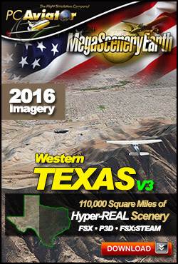
This particular page title is Western Texas and is approximately 110,000 square miles. It includes the cities of El Paso, Amarillo & Lubbock.
The text below describes the complete state of Texas, this particular page is for ordering Western Texas only. The image on the right shows the area covered.
This is a download edition with the option to order a DVD disk set (16 discs).
These links take you to ordering & information pages for other areas of Texas
Save $20
When you add all 3 Texas regions to your cart you will receive an automatic $20 discount.
|
The New MegaSceneryEarth Texas West V3 featuring unsurpassed image sharpness, scenery color and clarity, improved scenery features with accurate additional water bodies and topographical data and the latest aerial imagery available taken in 2016.
Fly the entire state - BORDER to BORDER - of Texas in photoreal detail.
The second largest state in the USA, Texas is massive at over 268,500 square miles in size and has 1466 airports.
You'll see everything that you see in Texas in real life in the scenery.
As an added bonus, we now provide all the VFR and IFR charts in digital PDF format to enable you to get the most out of your scenery. This includes 7 Sectionals, 2 Terminal Area Charts, 6 IFR enroute charts, 2 Terminal Area Charts and a 1709 page book of Instrument Approach plates, Airport Diagrams, SIDs and STARs, and an Airport Facility Directory. The charts are downloadable along with your scenery files.
Some of the cities and landmarks you'll get to enjoy as you explore Texas include:
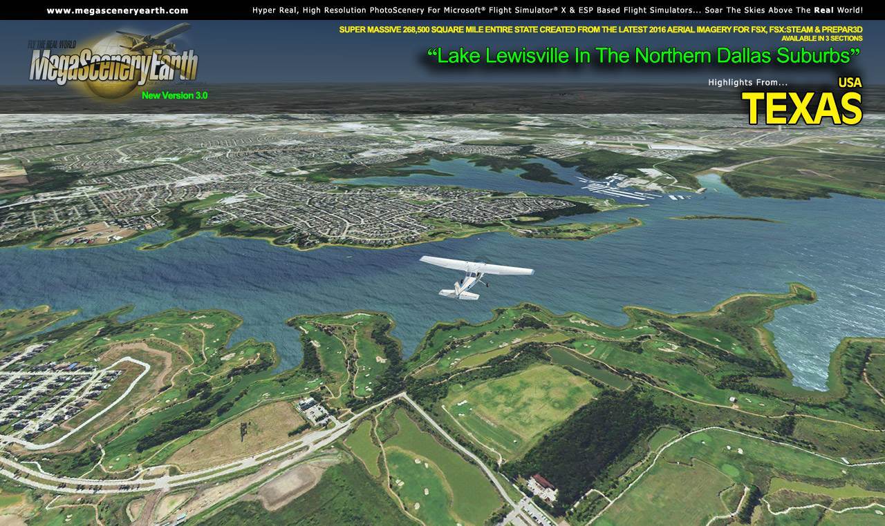
Cities: Dallas/Fort Worth, Houston, San Antonio, Austin, El Paso, Corpus Christi, Laredo, Lubbock, Amarillo
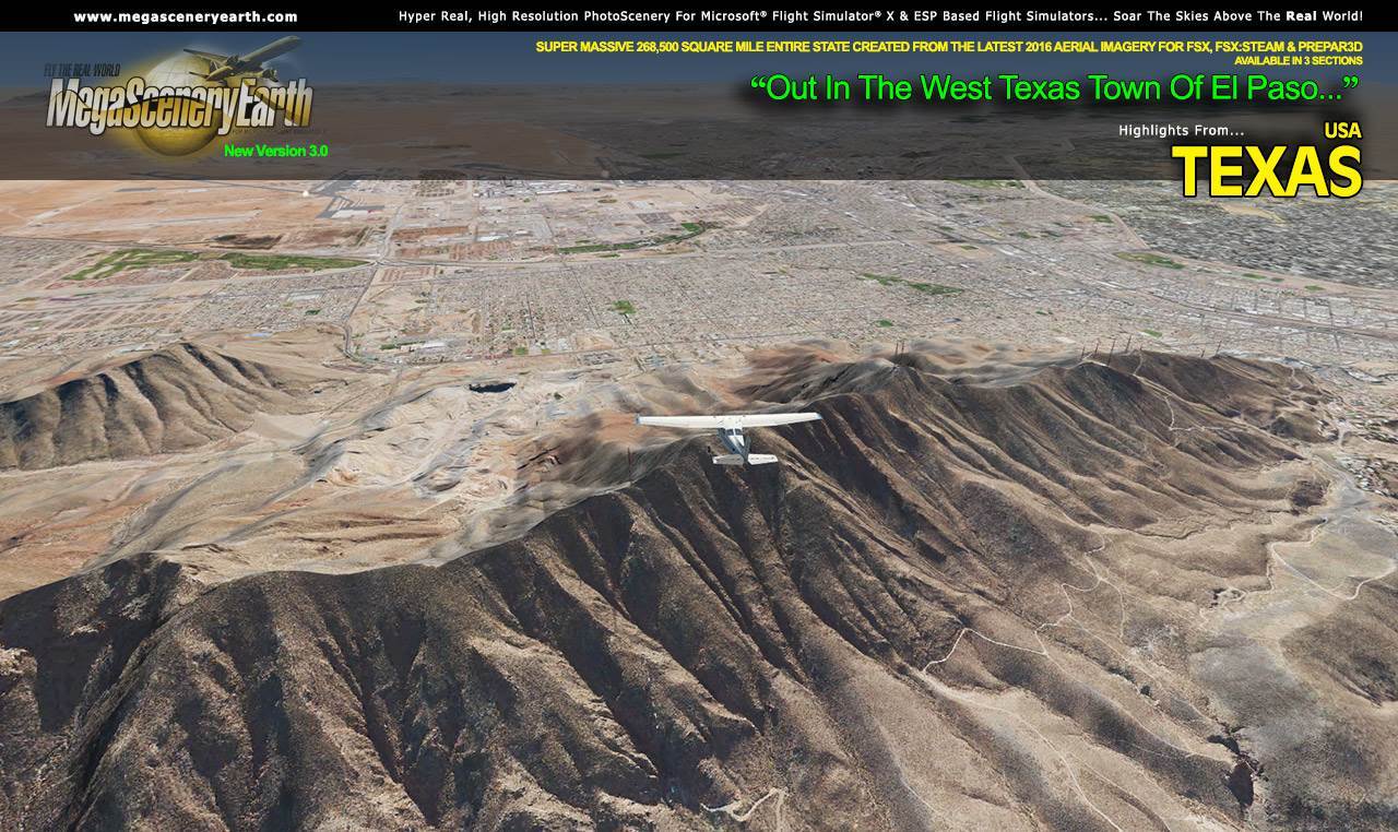
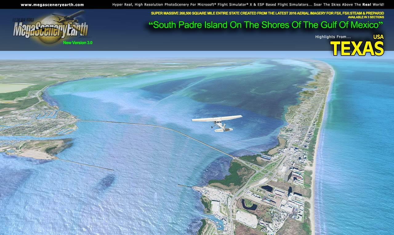
Lakes & Water Bodies: Toledo Bend Reservoir, Sam Rayburn Reservoir, Lake Texoma, Richland Chambers, Lake Livingston, Falcon Lake, Lake Amistad, Gulf Of Mexico Shoreline
Mountains & Hills: Guadalupe Peak (8,717 feet), Bush Mountain, Shumard Peak, Bartlett Peak, Baldy Peak and a total of 50 peaks above 6,700 ft.
State Parks & National Forests: Black Kettle & McLellan Creek & Rita Blanca National Grasslands, Angelina, Davy Crockett, Sabine, Sam Houston, Caddo/LBJ National Forests, Guadalupe National Park,
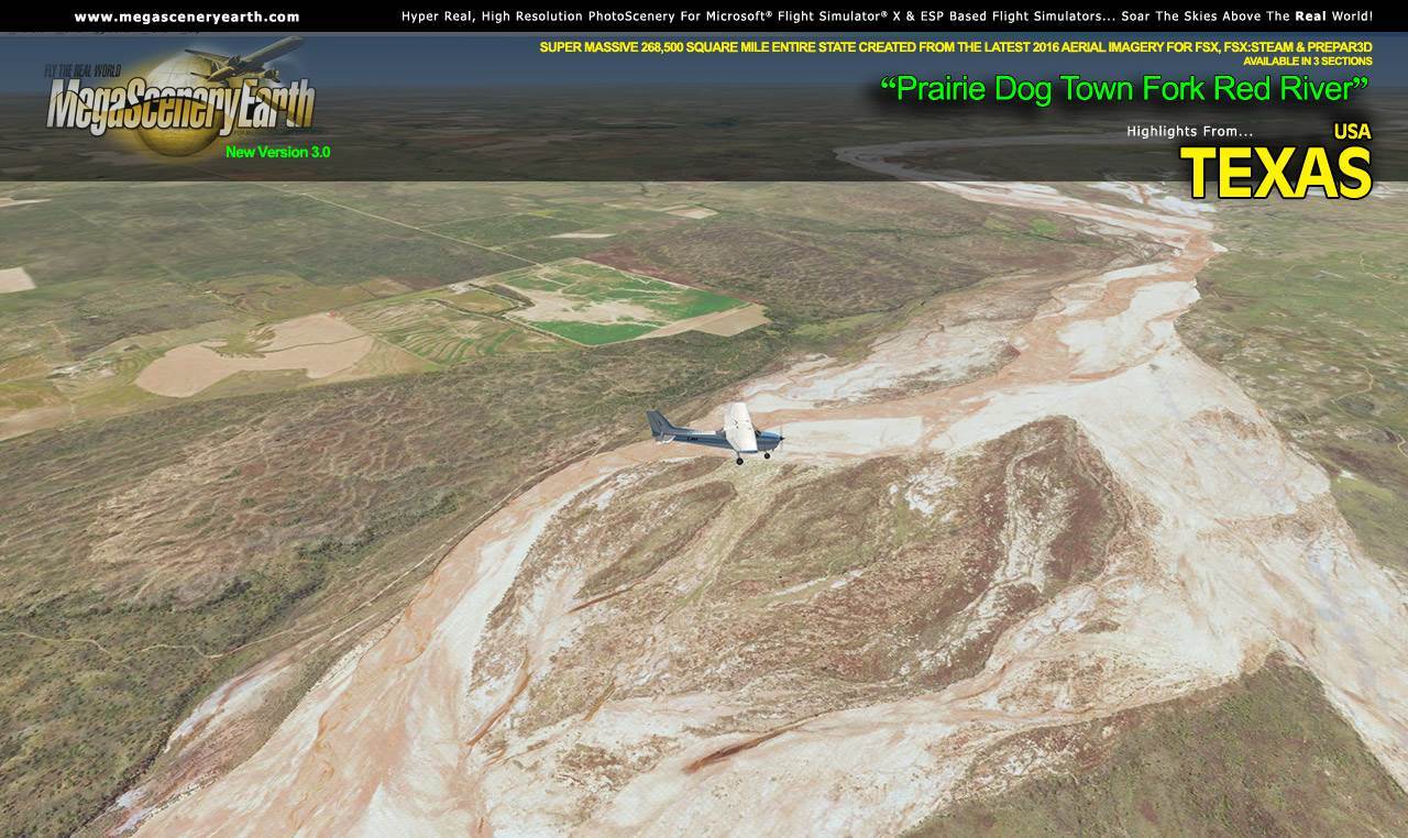
Major Rivers: Rio Grande, Red River, Brazos River, Sabine River, Colorado River, Pecos River
Discover the rest of it all for yourself! There's a LOT to see in this massive state!
When you order the DVD disk set you will still receive download links. If you do not wish to download, simply wait for your DVDs to arrive in the mail.
THIS TITLE COMES WITH A FULL SET OF FAA AERONAUTICAL CHARTS FOR Texas IN PDF FORMAT.
Here's what you get (download links for charts will be given to you with your product download):
SECTIONAL CHARTS: Albuquerque, Brownsville, Dallas/Fort Worth, Houston, Memphis, San Antonio, Wichita
TERMINAL AREA CHARTS: Dallas/Fort Worth, Houston
VFR FLYWAYS PLANNING CHARTS: Dallas/Fort Worth, Houston
LOW ALTITUDE IFR CHARTS: ELUS-05/ELUS-06,, ELUS-15/ELUS-16, ELUS-17/ELUS-18, ELUS-19/ELUS-20
HIGH ALTITUDE IFR CHARTS: EHUS-05/EHUS-06, EHUS-07/EHUS-08
AIRPORT FACILITY DIRECTORY: A FULLY INDEXED 170 PAGE PDF BOOKLET
APPROACH CHARTS & AIRPORT DIAGRAMS: A FULLY INDEXED 1709 PAGE PDF BOOKLET
|
|