Start it up, click any place on the globe and CoPilot Pro is ready, willing and able to get you to your destination effortlessly.
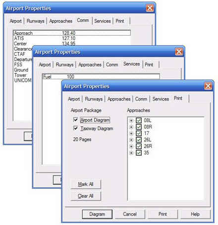
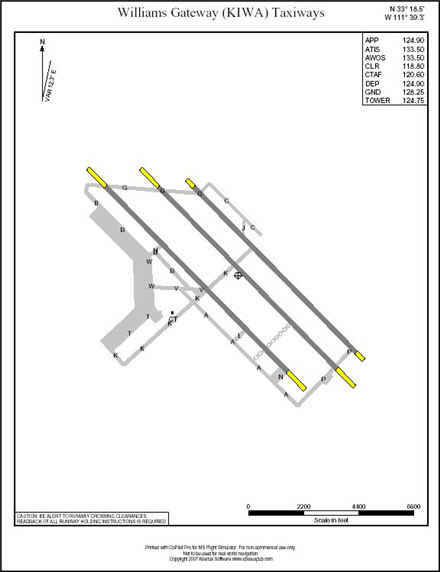
Before your flight, use CoPilot to create a superior flight plan. You'll conveniently print your plan, airport and taxi diagrams and approach plates as a single "package".
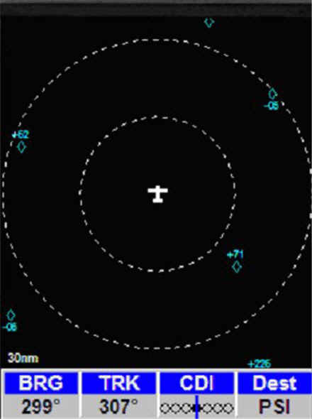
During your flight, the CoPilot EZ-GPS instrument lets you know where you are and where any other traffic may be too. The GPS couples to your autopilot and it can automatically fly you all the way down to decision height using any of the airport's published approaches.
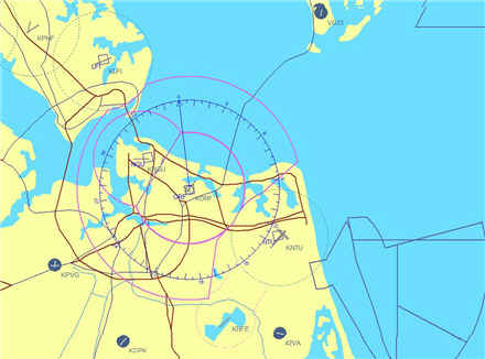
- Global Map - Single, integrated map provides worldwide coverage of airports and navaids along geo-political boundaries. The display is instantaneous as you zoom in, zoom out or pan. Optionally you can display the major roads in the USA.
- Navaids - CoPilot organizes and intelligently displays airports, approaches, fixes, VORs, NDB, intersections and air spaces. Navaids are displayed or hidden based on your preferences.
- Flight Planning - You can create a variety of plans quickly. Choose your routing via GPS, VORs, Victor and Jet airways. Routes are easily changable on the map using point and click. Plans are fully compatible with those made with FSX or FS2004.
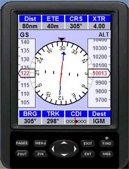
- GPS Instrument - This is one of the simplest, yet ingenious navigation instruments you'll ever use. As it takes you anywhere in the FS world, it keeps you informed as you're flying. It incorporates a top notch moving map page, multiple info pages and traffic (TCAS) page.
- AutoPilot Link - The GPS automatically couples to your autopilot and makes "hands-off" navigation a reality. Using a CoPilot flight plan, it can fly your aircraft right down to the decision height.
- GPS Setup - The GPS instrument is usable by any FS aircraft and iinstalls instantly with simple two-click operation
- Airman's Guide - CoPilot prints handsome area maps, flight plans, airport and taxiway diagrams, approach plates. Convenient one-click "flight package" prints all of the documents required for a single flight.
The CoPilot flight planner produces efficient and flexible routings to your destination.
All CoPilot flight plans are fully compatible with Flight Simulator X and 2004. Additionally, your flight plan may include any of the published approaches available at your destination airport.
Using CoPilot's very capable GPS instrument (included), this flight plan can fly your aircraft to your destination runway all the way down to decision height.
If you're one of those who like to tweak, you can alter the flight plan by inserting or removing waypoints on the map with click and point ease. The changes to the routing on the map are then instantly reflected in your flight plan. |
|