GMapHD for Windows gives you a great moving map for your desktop flight simulator!
This is a versatile app, designed to run on Microsoft Windows (7 or later) but supports the most widely-used desktop simulators on the market (MSFS, P3D, FSX, FS2004, X-Plane or Aerofly FS 2) on multiple platforms.
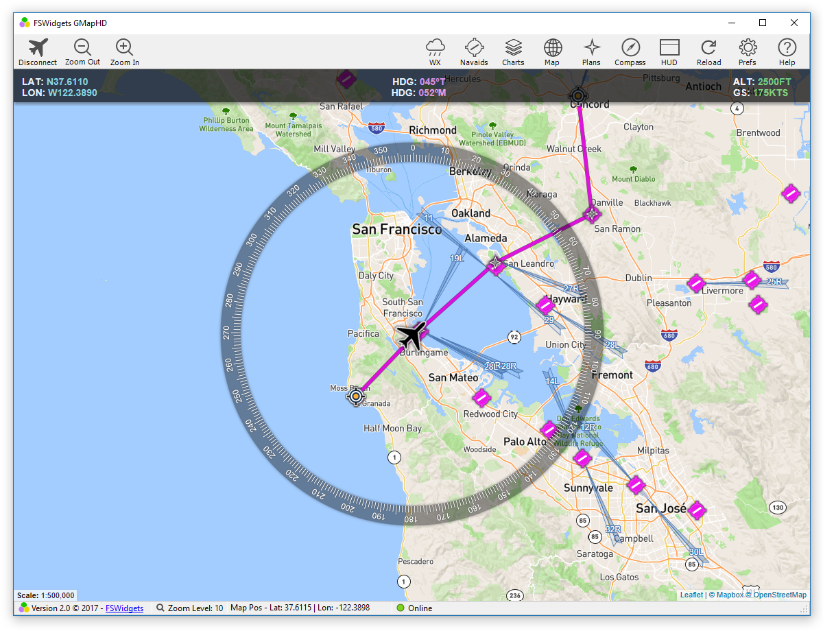
It comes pre-packed with a huge collection of bonus Aero Charts and Nav Data (usable within GMapHD only) giving you a large map display to aid navigation, especially on VFR flights.
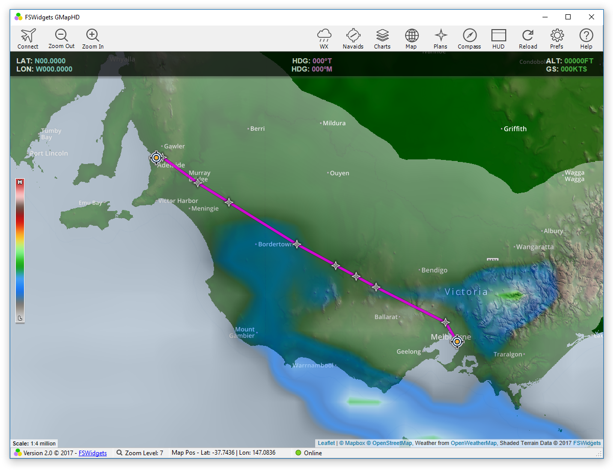
The map also features several weather data overlays including US Nexrad, world-wide Metar/TAF stations, cloud, rain, pressure and wind.
Local and network connectivity is provided via the free FSWidgets Network Pack utility.
This app can be used in the following configurations:
-
Connect locally and remotely to MSFS (Windows)
-
Connect locally and remotely to P3D (Windows)
-
Connect locally and remotely to FSX (Windows)
-
Connect locally and remotely to FS2004 (Windows)
-
Connect locally and remotely to X-Plane (Windows)
-
Connect remotely to X-Plane (macOS)
-
Connect locally to Aerofly FS 2 (Windows)
-
Connect locally and remotely to Aerofly FS 2 (Windows & macOS)
-
Connect remotely to Aerofly FS 2 / FS 2020 (Android & iOS)
Features:
-
Designed to run on Windows (7 or later)
-
Supports MSFS, P3D, FSX, FS2004, X-Plane or Aerofly FS 2
-
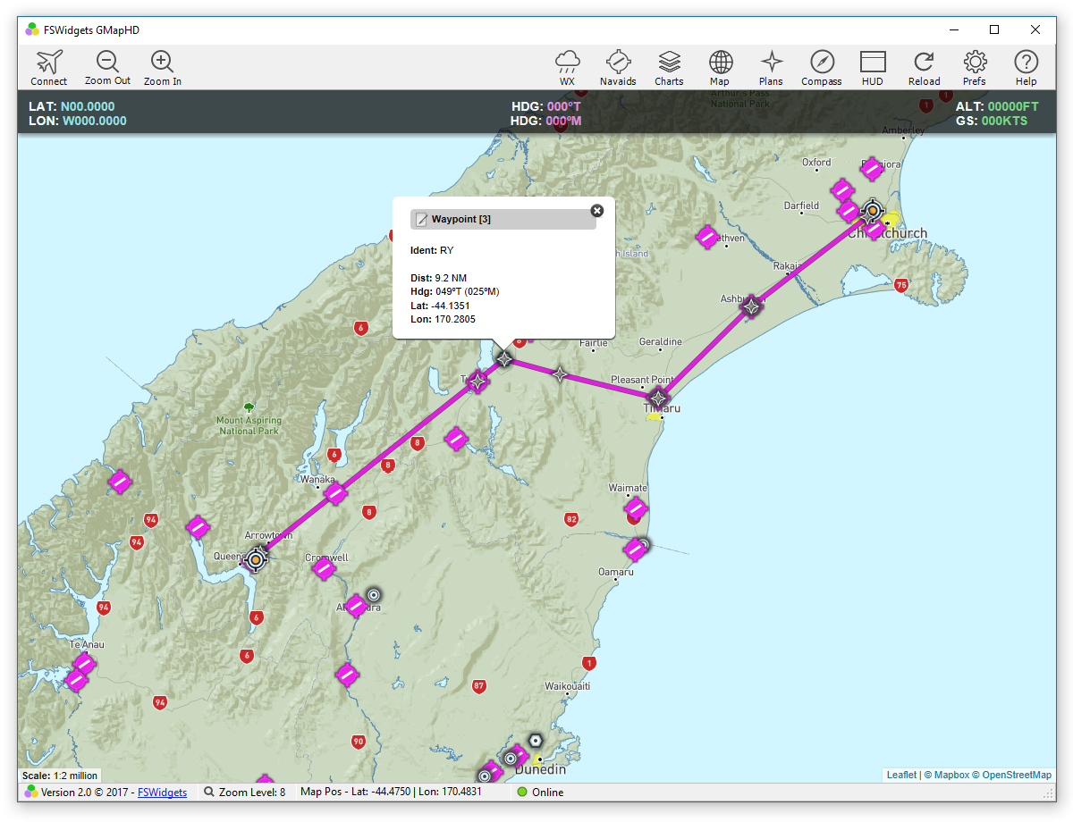
Flight Plan Display - supports native FSX, FS2004 & X-Plane flight plan files
-
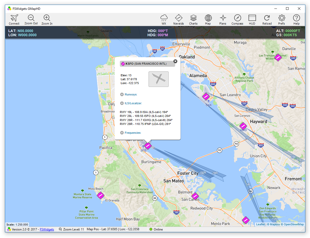
Flight plan waypoints can be clicked to reveal the related data (lat, lon, ident)
-
Free FSWidgets Network Pack to connect to the sim
-
Powered by Leaflet map rendering API (OpenStreetMap data)
-
Connect & disconnect from the flight simulator as required
-
When disconnected can be used as a chart viewer
-
Option to save previously used map type, zoom and position
-
Helicopter icon option for moving map (i.e. instead of fixed wing icon)
-
Many Aero Charts (details below)
-
Nav Data icon display (details below)
-
World-wide Metar & TAF Station display option
-
World-wide Clouds, Rain, Pressure and Wind data overlays
Included Cloud Based Aero Chart & Nav Data:
-
US SEC (Sectional Chart)
-
US WAC (World Aeronautical Chart)
-
US TAC (Terminal Area Charts)
-
US Enroute High
-
US Enroute Low
-
US VFR Wall Planner
-
US IFR Planning Chart
-
US Heli Route (9 Major cities).
-
Alaska SEC
-
Alaska WAC
-
Alaska Enroute Low
-
Alaska Enroute High
-
Cuba and Puerto Rico WAC
-
South America ONC (Operational Navigation Chart)
-
Canada ONC
-
Europe ONC
-
Europe TPC (Tactical Pilotage Charts)
-
Australia ONC
-
New Zealand Aero Chart
-
New Zealand TPC
-
Spain Enroute Low
-
Belgium Aero OFM (open flightmaps)
-
Netherlands Aero OFM
-
Denmark Aero OFM
-
Sweden Aero OFM
-
Germany Aero OFM
-
Switzerland Aero OFM
-
Austria Aero OFM
-
Poland Aero OFM
-
Czech Republic Aero OFM
-
Hungary Aero OFM
-
Slovenia Aero OFM
-
Croatia Aero OFM
-
Romania Aero OFM
-
Bulgaria Aero OFM
-
World-wide Nav Data (airports, seaplane facilities, VOR's, NDB's and Fixes)
Requirements
-
Desktop PC or laptop running Windows (7 or later)
-
Internet Explorer 10 or later
-
Supported Simulators: MSFS, P3D, FSX, FS2004, X-Plane or Aerofly FS 2 (Windows & macOS)
-
For MSFS, FSX & P3D: SimConnect must be installed on the Windows system
-
Free FSWidgets Network Pack must be installed to connect to simulator (both locally or remotely)
-
For remote connections, network required. Other machine must be on same local network as simulator
-
Internet access required to access the online mapping engine
Documents:
|