The New MegaSceneryEarth South Carolina V3 featuring unsurpassed image sharpness, scenery color and clarity, improved scenery features with accurate additional water bodies and topographical data and the latest aerial imagery available taken in 2015.
Y'all in the deep south now as you soar the Flight Simulator skies above the state of South Carolina, a state that played a big part in US history and you can now add to your own history of one of the places you've flown.
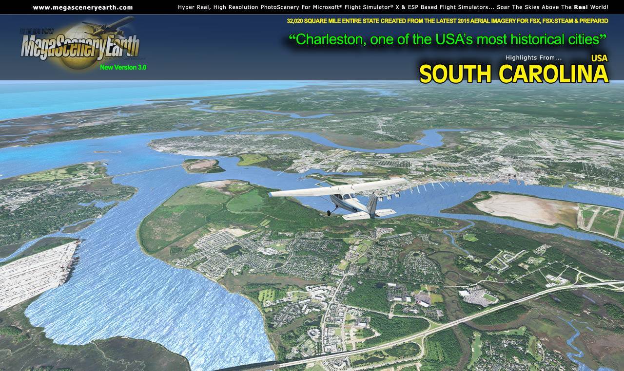
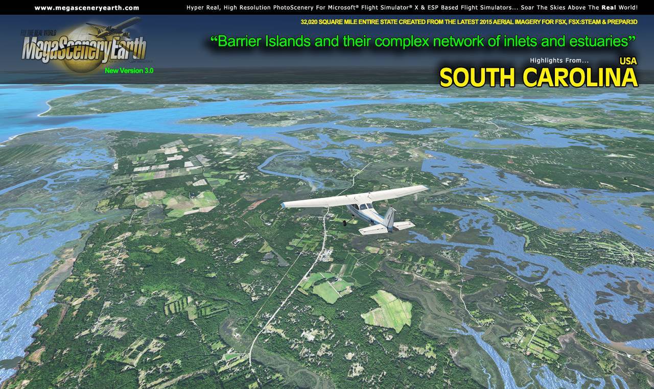
The land is rich, green and diverse being touched by the Blue Ridge mountains in the upstate to the flattest land you'll ever fly as you navigate your way over the low country enroute to the famous and stunningly beautiful historic city of Charleston and you can even see all of that history from the vantage point of your cockpit.
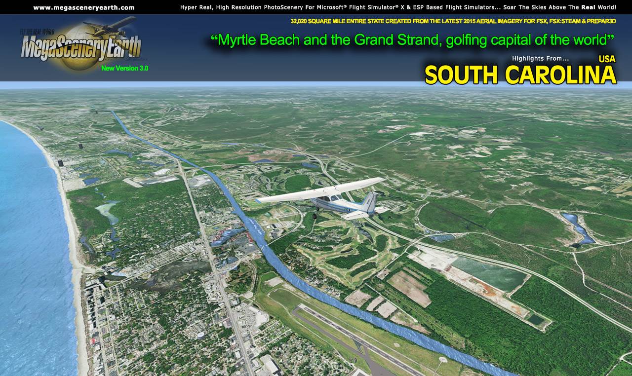
Then turn heading 030 and make your way towards the golfing capital of the world, Myrtle Beach on the Atlantic coast. One town, 125 golf courses and counting. And you'll see every one of them from your cockpit.
There's thousands of hours of flying to be done over the 32,000 square miles of diverse terrain, all recreated from 50 cm per pixel aerial photography and over 173 airports for you to use as landing and departure points as you enjoy the scenery.
The large size of this state enables you to enjoy flights of up to 250 miles from border to border. Enjoy South Carolina!
Some of the cities and landmarks you'll get to enjoy as you explore South Carolina include:
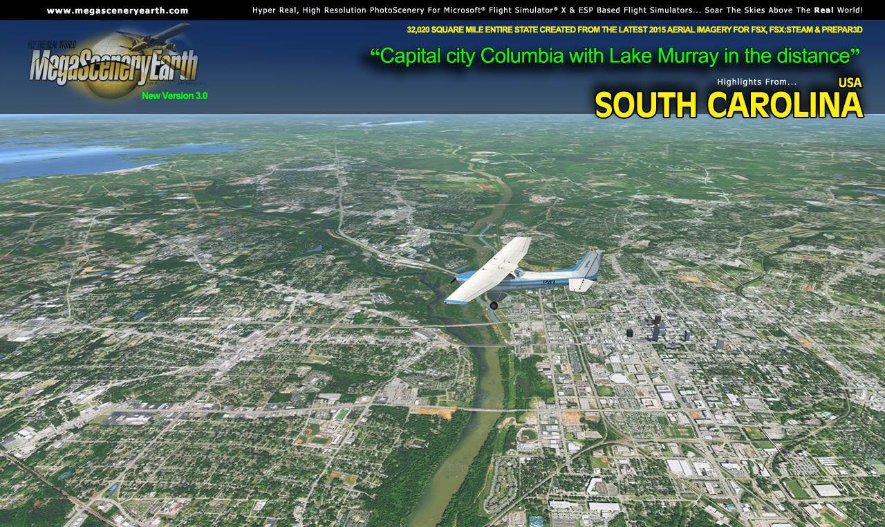
Cities: Columbia (largest & Capital), Charleston, Greenville, Florence, Rock Hill, Summerville, Sumter, Spartanburg, Myrtle Beach
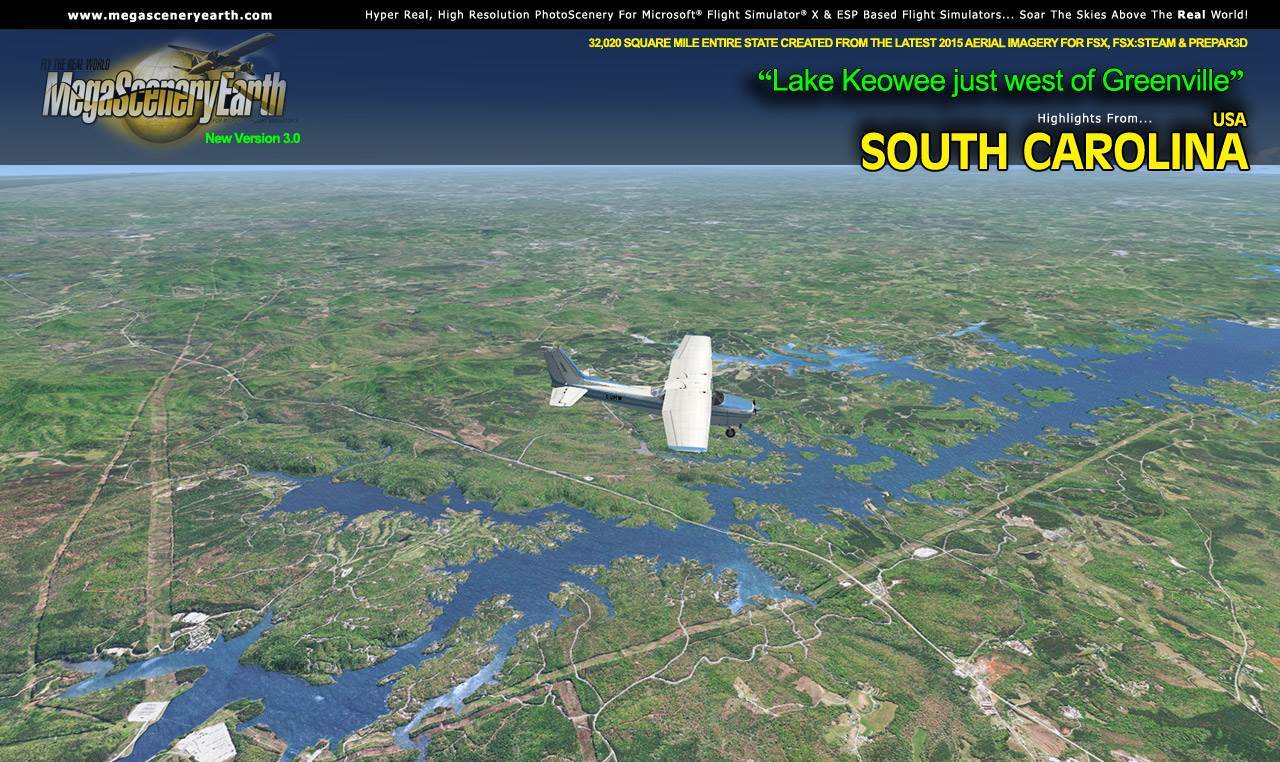
Lakes: Lake Marion, Lake Moultrie, Lake Jocassee, Lake Keowee, Lake Greenwood, Lake Murray,
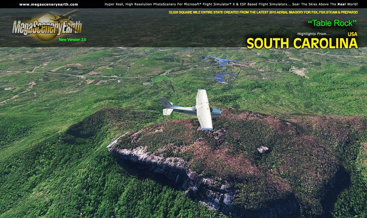
Mountains: Blue Ridge Mountains, Sassafras Mountain (3,547 ft), Hickorynut (3,488 ft), Pinnacle (3,415 ft), Coldbranch (3,333 ft), Slicking (3,323 ft), Bradford (3,317 ft) and a total of 50 mountains above 2,500 feet.
State Parks & National Forests: Jocassee, Mountain Bridge, Kings Mountain, Sandhills State Forest, Cheraw, Francis Marion National Forest, Sumter National Forest
Major Rivers: Pee Dee, Santee, Catawba, Saluda, Savannah, Edisto, Broad, Intercoastal Waterway, Waccamaw
Some Other Major Landmarks & Highlights: Myrtle Beach & The Grand Strand, Charleston Harbor & Historic District, Fort Sumter, Hilton Head
Discover the rest of it all for yourself! There's a LOT to see!
This is a download edition with the option to order a DVD disk set (7 discs).
When you order the DVD disk set you will still receive download links. If you do not wish to download, simply wait for your DVD to arrive in the mail.
THIS TITLE COMES WITH A FULL SET OF FAA AERONAUTICAL CHARTS FOR KENTUCKY IN PDF FORMAT.
Here's what you get (download links for charts will be given to you with your product download):
SECTIONAL CHARTS: Atlanta & Charlotte
LOW ALTITUDE IFR CHARTS: ELUS-23/ELUS-24, ELUS-25/ELUS-26, ELUS-35/ELUS-36
HIGH ALTITUDE IFR CHARTS: EHUS-9/EHUS-10
AIRPORT FACILITY DIRECTORY: A 36 PAGE PDF BOOKLET
APPROACH CHARTS & AIRPORT DIAGRAMS: A 295 PAGE PDF BOOKLET
FREE DOWNLOAD: CLICK HERE FOR FREE PHOTO ALIGNED AIRPORTS FOR SOUTH CAROLINA
|