Ultra-Res Cities take MegaSceneryEarth realism to a whole new level with unprecedented native 60 cm or better resolution scenery for larger cities and Terminal Control Areas.
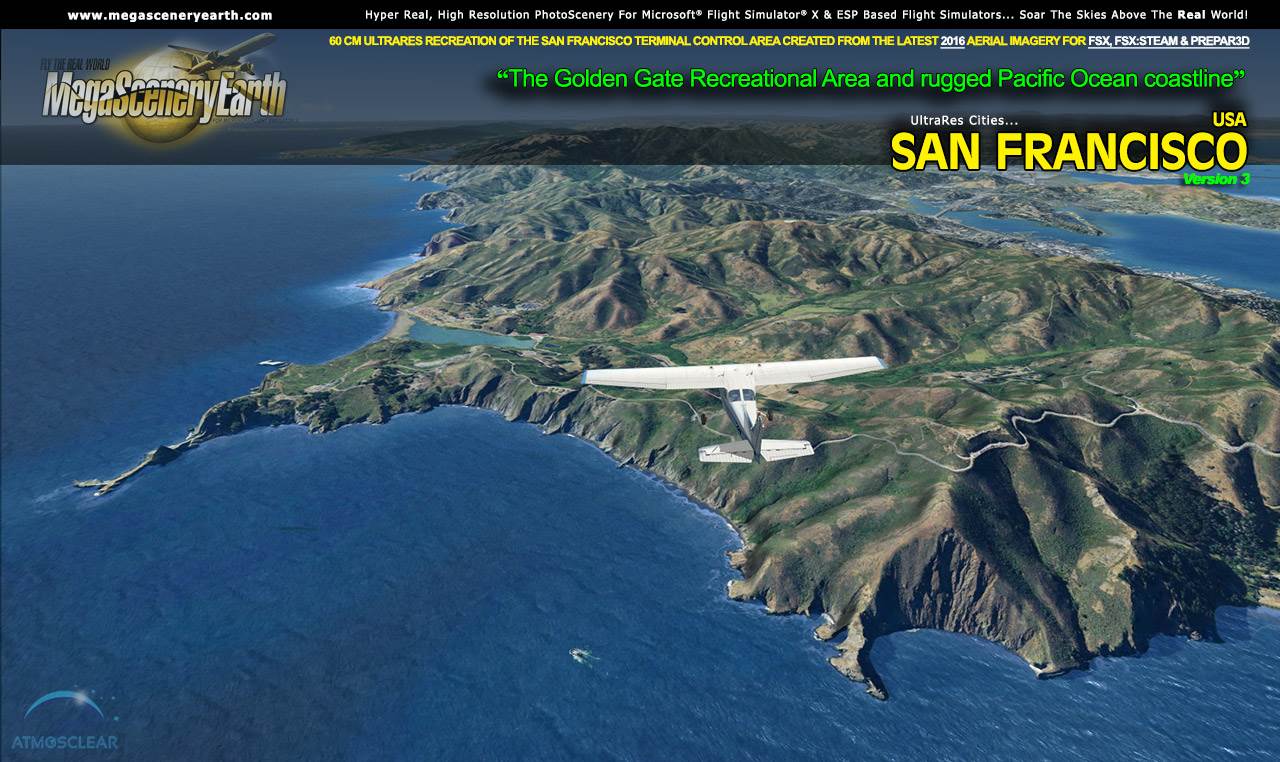
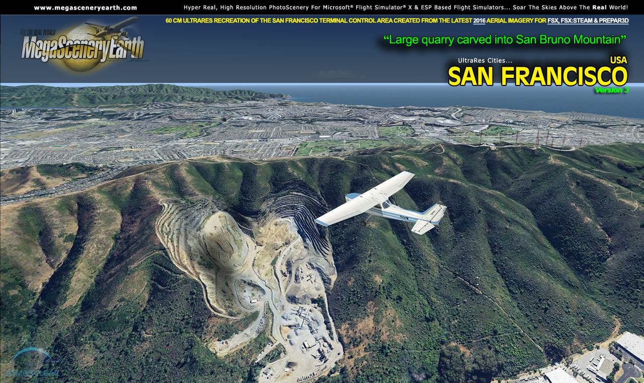
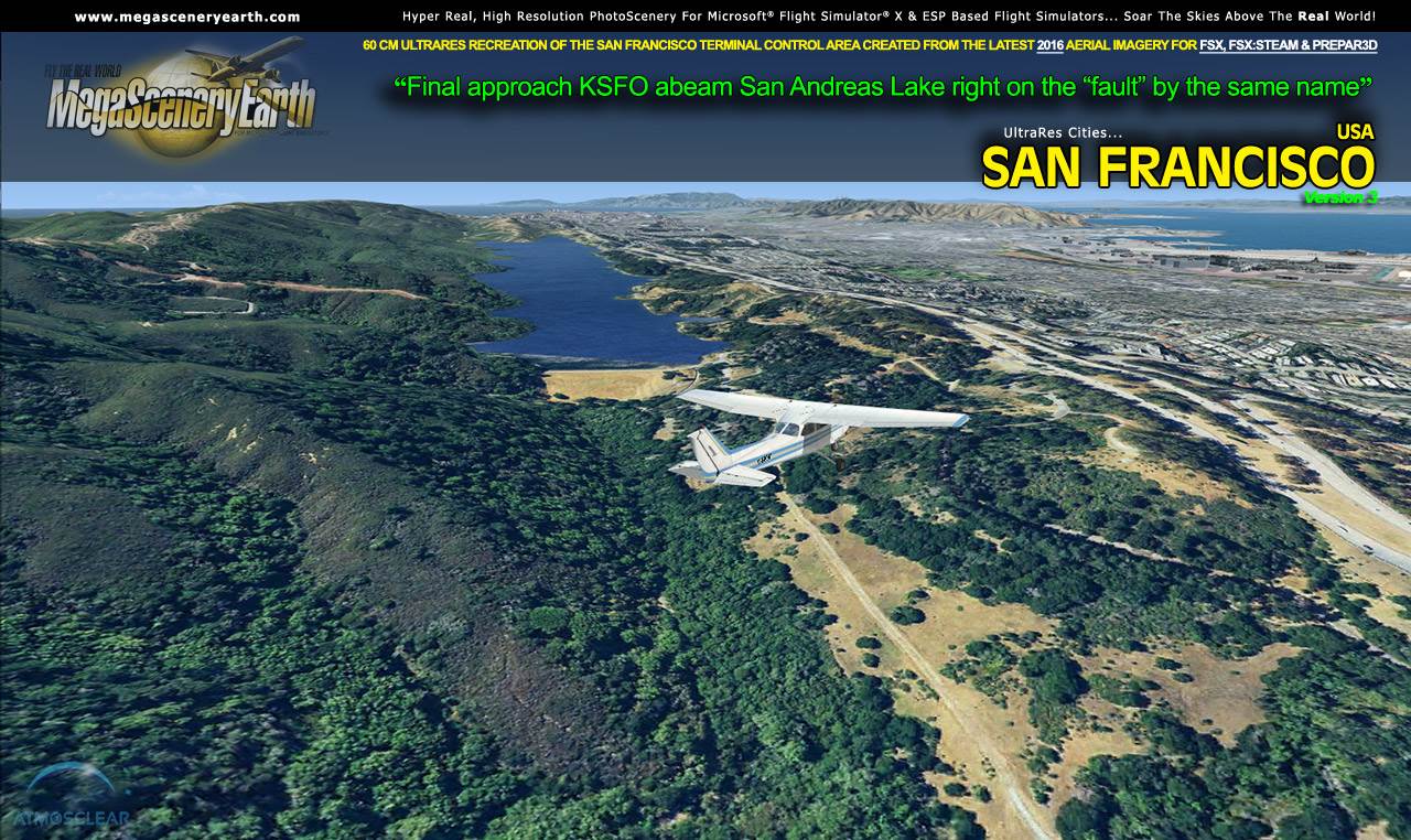
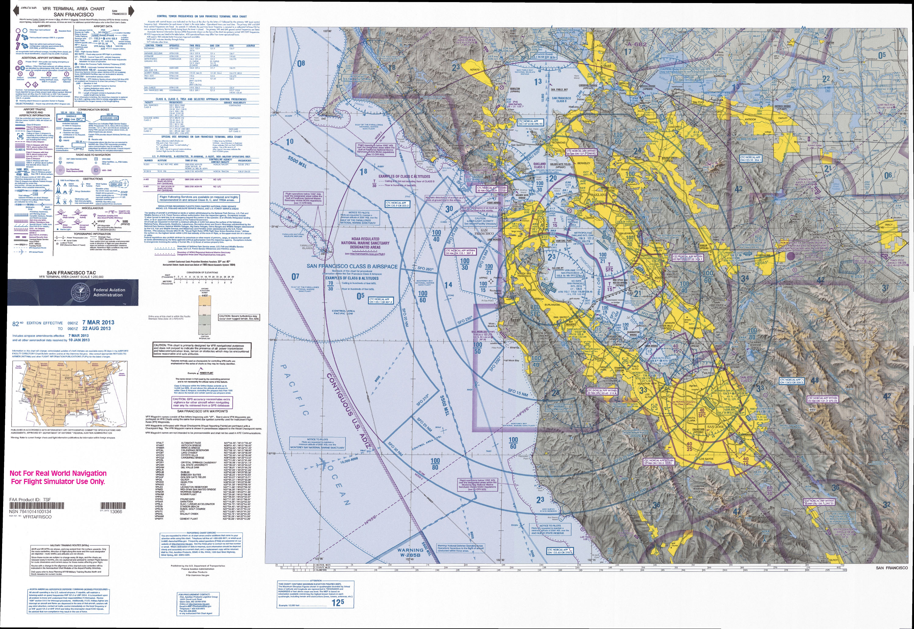
This titles gives you the Terminal Area for San Francisco, CA (shown by the pdf chart link above) around 7,000 square miles of the all displayed at 60 cm per pixel.
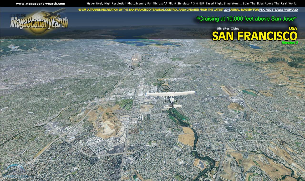
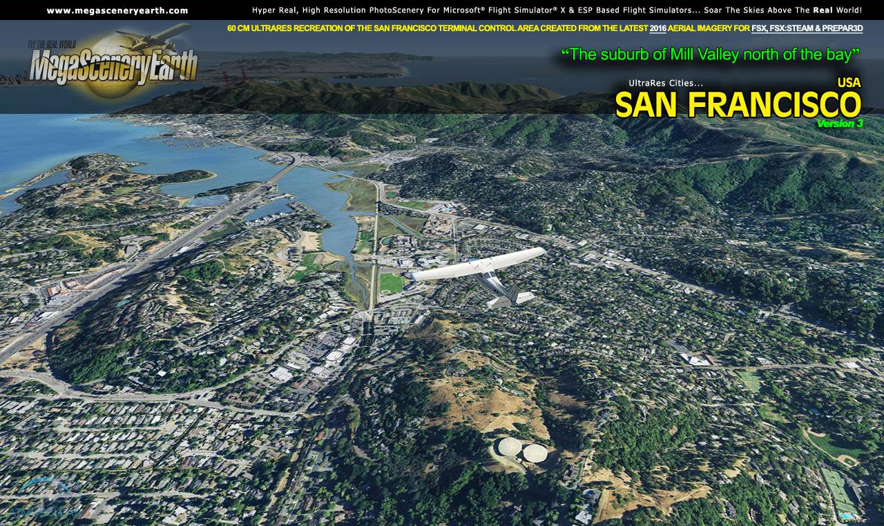
The realism is simply stunning. You can fly this scenery and it remains clear right down to lower altitudes of around 500 feet. Perfect for helicopter flying around cities as well as cross city shorter flights in light aircraft or for ultra-realism while approaching and landing at a Terminal Control Area in a big jet.
This terminal area can co-exist with your California complete state scenery. Place the Ultra-Res city above the state scenery in your scenery library.
 Features New AtmosCLEAR™ Image Clarity Features New AtmosCLEAR™ Image Clarity
San Francisco imagery is processed using our proprietary AtmosCLEAR™ image processing. AtmosCLEAR™ is a post production image processing technique that simulates the image being photographed in a vacuum to eliminate all atmospheric haze and artifact. It's clear of atmosphere. The result is a crystal clear mathematically optimally contrasted image.
Fly The San Francisco Area Both Day and Night
Ultra-Res Cities San Francisco blends seamlessly with FSX and Prepar3D night scenery so that dawn and dusk feature a blend of aerial imagery and night lighting while the scenery transitions to full day or full night where all default FSX night scenery displays.
Complete Hydrography For The Area
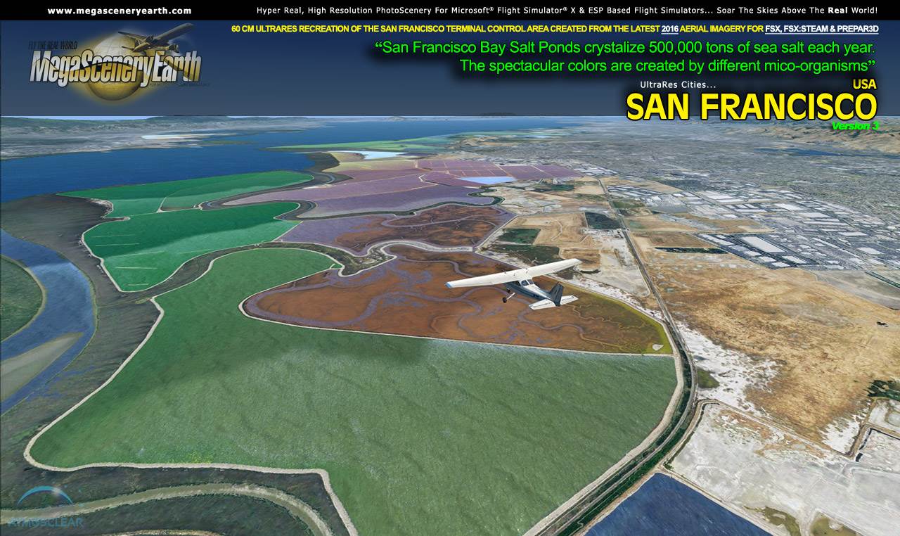
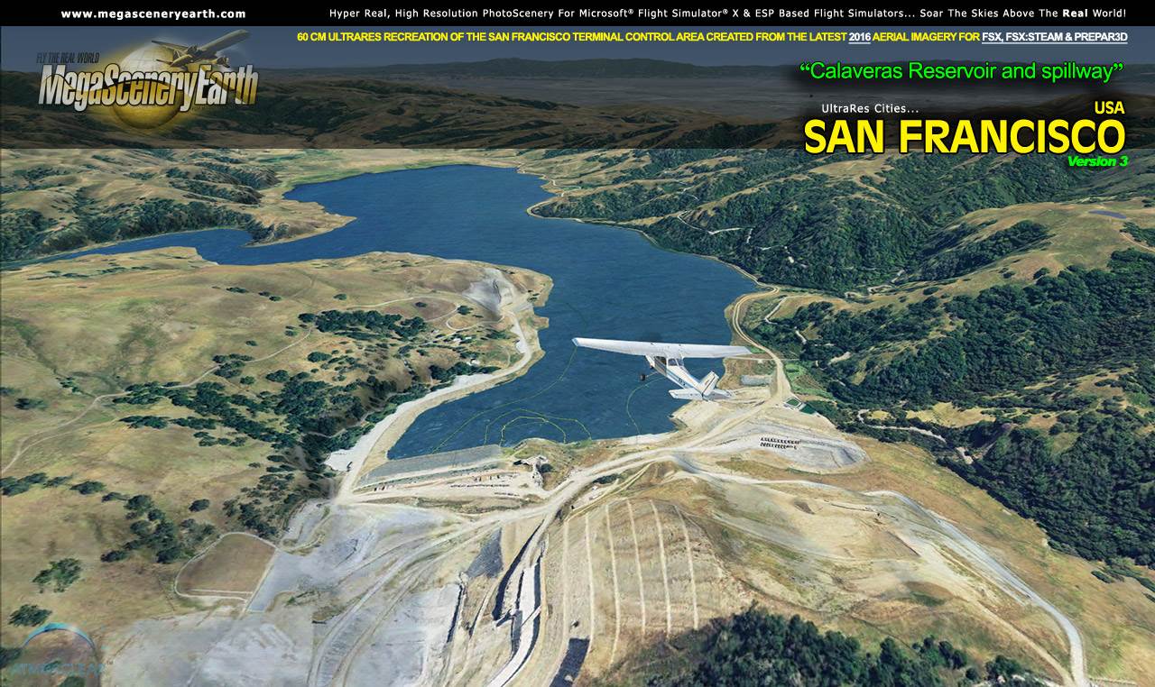
Ultra-Res Cities San Francisco also features Flight Simulator water effects on all lakes, ponds and reservoirs greater than 3 acres from the national hydrographic database. If the water body is greater than 5 sq km, then its shorelines are hand etched pixel by pixel for highly accurate shorelines. Wide rivers also have hand etched shorelines and banks. The raw photographic water body is left untouched with the result being an authentic variety of different water colors that highlight specific properties e.g. mineral lakes whose color is maintained. Where possible water surface artifact is removed from the image. For users who like to see the water bodies as they are, then simply turn off the simulator water effects and you will see the native aerial images of the water bodies as you fly. Specific characteristics of narrower rivers require that we do not apply water effect to narrow rivers and creeks for a better scenery result.
All The Charts You Need To Navigate The San Francisco Terminal Area
As an added bonus, we now provide all the VFR and IFR charts in digital PDF format to enable you to get the most out of your scenery. This includes 5 Sectionals, 3 Terminal Area Charts, 7 IFR enroute charts, 3 VFR Flyways Planning Charts and a 1046 page book of Instrument Approach plates, Airport Diagrams, SIDs and STARs, and an Airport Facility Directory. The charts are downloadable along with your scenery files.
As an added bonus, we provide all the VFR and IFR charts in digital PDF format to enable you to get the most out of your Terminal Area flying. This includes 3 Sectionals, 4 IFR enroute charts, and a 262 page book of Instru ment Approach plates, Airport Diagrams, SIDs and STARs, and an Airport Facility Directory. The charts are downloadable along with your scenery files. ment Approach plates, Airport Diagrams, SIDs and STARs, and an Airport Facility Directory. The charts are downloadable along with your scenery files.
Download the San Francisco Terminal Area PDF above. The area covered by this area is exactly the area covered in the Terminal Area Chart.
THIS TITLE COMES WITH A FULL SET OF FAA AERONAUTICAL CHARTS FOR California IN PDF FORMAT.
Here's what you get (download links for charts will be given to you with your product download):
SECTIONAL CHARTS: Klamath Falls, Las Vegas, Los Angeles, Phoenix, San Francisco
TERMINAL AREA CHARTS: Los Angeles, San Diego, San Francisco
VFR FLYWAYS PLANNING CHARTS: Los Angeles, San Diego, San Francisco
LOW ALTITUDE IFR CHARTS: ELUS-01/ELUS-02, ELUS-03/ELUS-04, ELUS-05/ELUS-06, ELUS-07/ELUS-08, ELUS-09/ELUS-10, ELUS-11/ELUS-12
HIGH ALTITUDE IFR CHARTS: EHUS-03/EHUS-04
AIRPORT FACILITY DIRECTORY: A FULLY INDEXED 150 PAGE PDF BOOKLET
APPROACH CHARTS & AIRPORT DIAGRAMS: A FULLY INDEXED 1046 PAGE PDF BOOKLET
Delivery
This is a download edition with the option to order a DVD disk set (3 discs) or 16 Gb Flash Drive.
When you order the DVD or Flash Drive you will still receive download links. If you do not wish to download, simply wait for your media to arrive in the mail.
|