Our third Australian state enables you to fly Australia's most populated state, New South Wales in photoreal detail.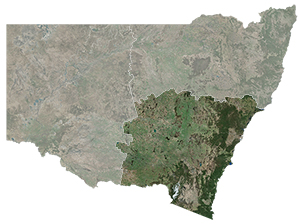
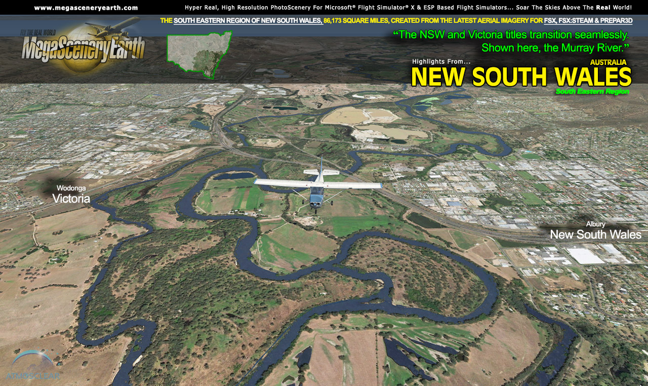
Due to it's massive size of 312,000 square miles, New South Wales has been divided into 3 regions - South Eastern, North Eastern and Western. This title is South Eastern NSW and gives you 86,173 square miles from the Victorian border up to Newcastle. This is the darkened area highlighted in the thumbnail on the right.
New South Wales completes a large swath of the most populated region of Australia enabling flight from Hobart all the way to Sydney and beyond.
This North East NSW title is the first of the three NSW titles with the other two titles being released within the next month.
The description to follow describes the entire NSW, however this page enables you to order the South East portion (86,173 sq mi) as per the thumbnail above.
Border To Border
Fly the entire state - BORDER to BORDER - of New South Wales in photoreal detail in 1 meter per pixel resolution throughout.
New South Wales is 312,528 square miles and has 85 public airports.
You get to fly over a variety of gorgeous scenery from the flat dry lands and salt lakes in the west, to the mountains of the Great Dividing Range in the east as well as the beaches and cliffs of the 1,328 miles of carefully etched Pacific Ocean coastline.
You'll see everything that you see in New South Wales in real life in the scenery. The clarity of the imagery is stunning.
If you're training to be a pilot, are an actual licensed pilot or just a flight simmer with big dreams of flying, this scenery for the entire state if New South Wales is just what you need to enjoy a part of Australia in photoreal detail, as a training aid or to simply experience flying over a real Victoria on your PC Sim - FSX, FSX:STEAM or Prepar3D.
This title also includes the Australian Capital Territory (ACT) including Australia's capital city - Canberra.
Fly New South Wales Both Day and Night
New South Wales blends seamlessly with FSX and Prepar3D night scenery so that dawn and dusk feature a blend of aerial imagery and night lighting while the scenery transitions to full day or full night where all default FSX night scenery displays.
Selected New South Wales Hydrography
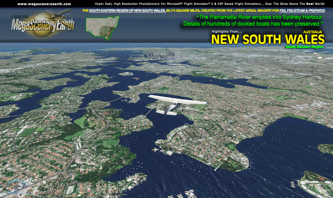
New South Wales also features Flight Simulator water effects and highly accurate hand etched shorelines all lakes, ponds and reservoirs greater than 1 sq km. Wide rivers also have hand etched shorelines and banks. The raw photographic water body is left untouched with the result being an authentic variety of different water colors that highlight specific properties e.g. mineral lakes whose color is maintained. Where possible water surface artifact is removed from the image. For users who like to see the water bodies as they are, then simply turn off the simulator water effects and you will see the native aerial images of the water bodies as you fly. Specific characteristics of narrower rivers require that we do not apply water effect to narrow rivers and creeks for a better scenery result.
Realigned and PhotoScenery Optimized Airports
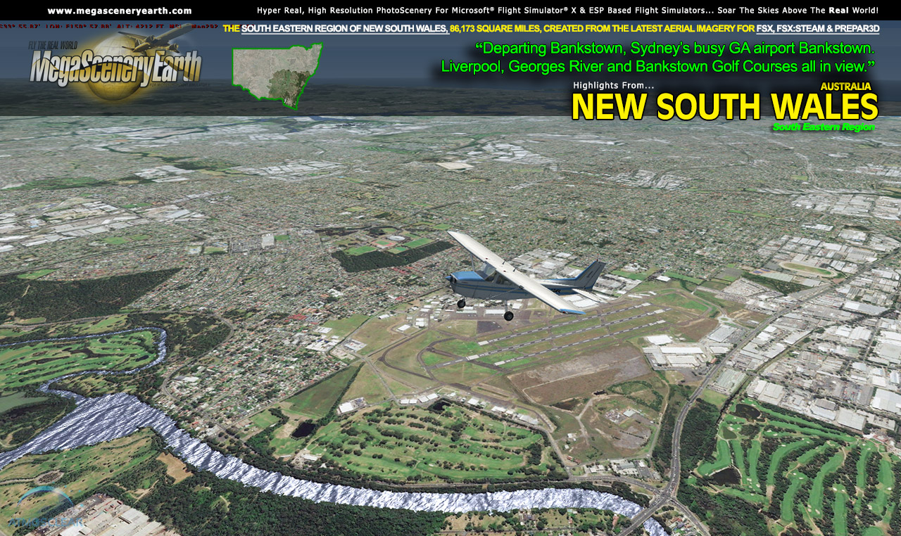
Photoscenery tends to make misaligned airports and runways stand out. We've gone through the entire list of primary airports in the state and realigned any misaligned runways and removed all other airport infrastructure so that the airports are optimized for display over the photoreal scenery. We've also reclassified any misclassified runway surfaces, e.g. paved vs gravel, dirt, grass, etc. These photoreal optimized airports do not preclude you from using any 3rd party airports which, when created accurately, will properly overlay over the photoscenery.
Some of the cities and landmarks you'll get to enjoy as you explore New South Wales include:
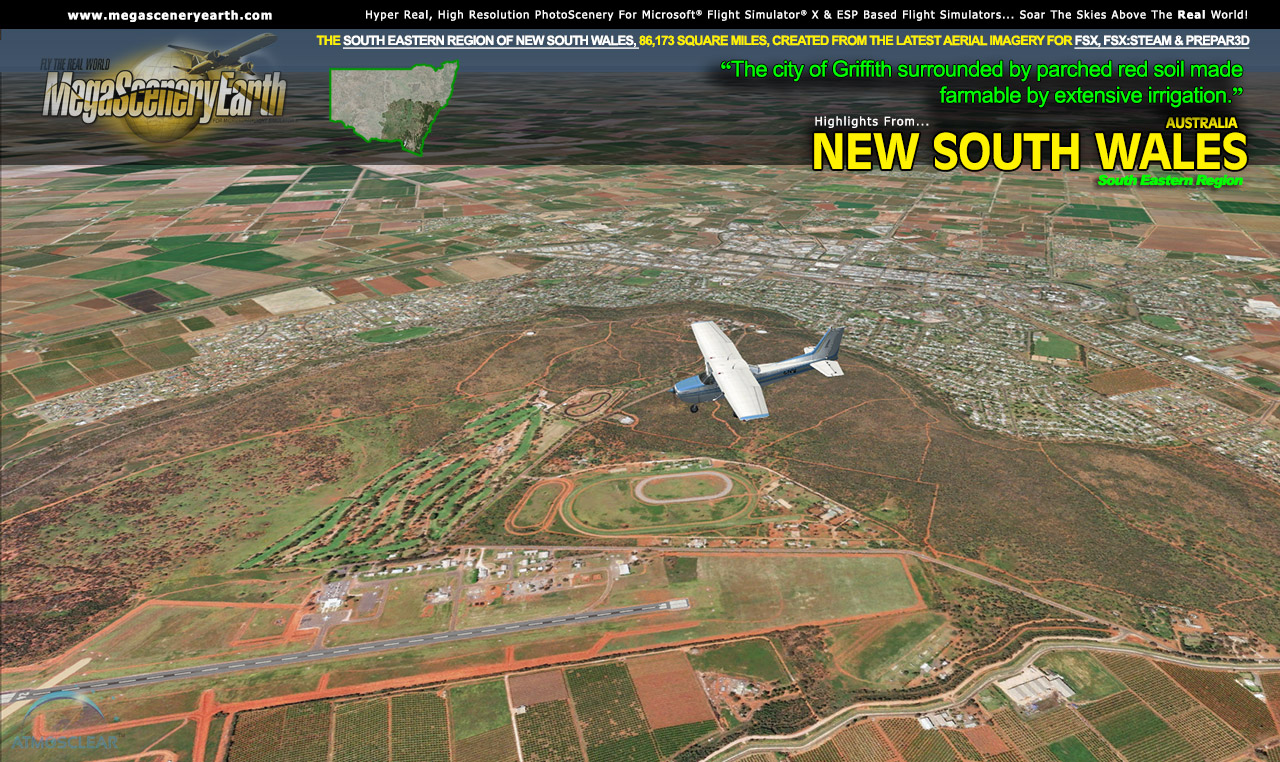
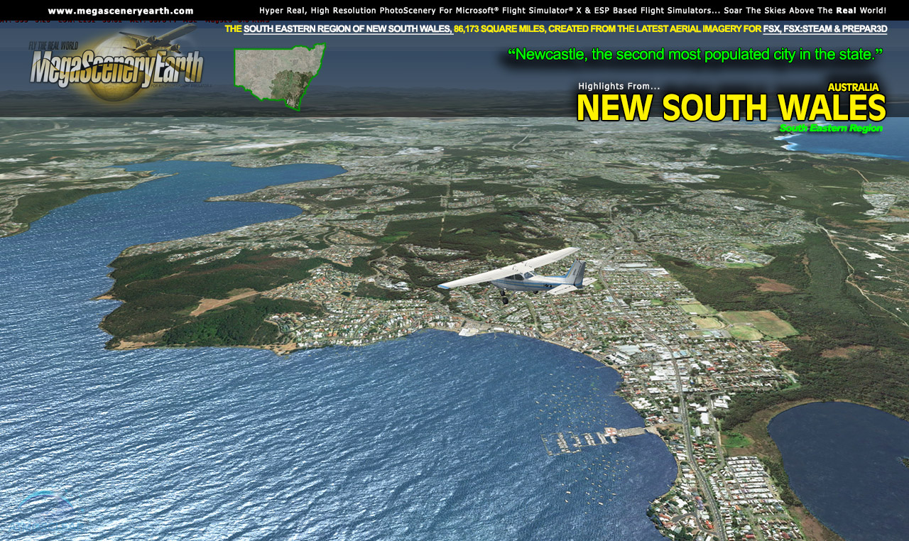
Cities and Towns: Sydney, Canberra, Newcastle, Wollongong, Maitland, Tweed Heads, Wagga Wagga, Albury, Port Macquarie, Coffs Harbor, Tamworth
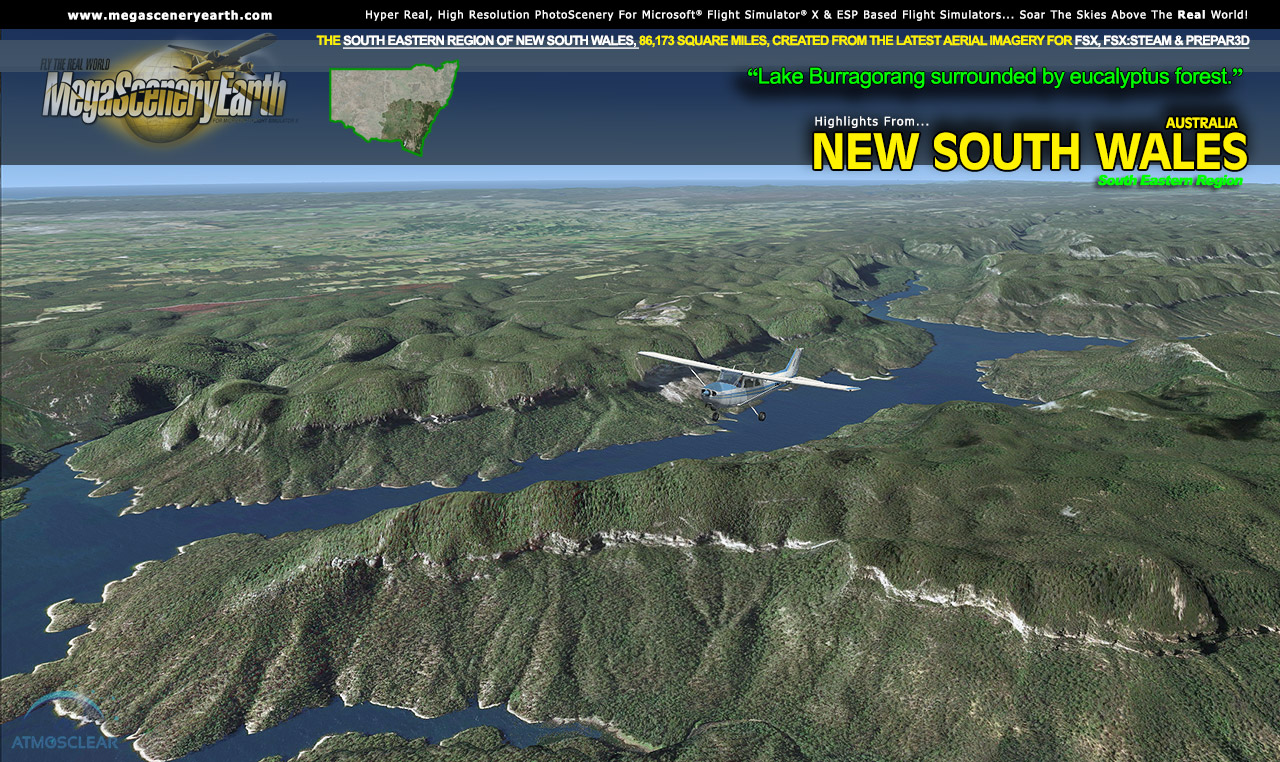
Lakes & Water Bodies: Lake Eucumbene, Garnpung Lake, Lake Victoria, Lake Tandou, Lake George, Lake Menindee, Mulurulu Lake
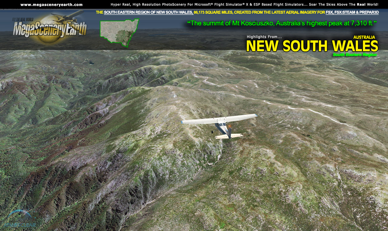
Mountains & Hills: Mt Kosciuszko (7,310 ft - Australia's highest peak), Mt Townsend, Mt Twynam, Rams Head, Carruthers Peak, Mount Tate, Mount Perisher and a total of 50 peaks above 4,500 feet.
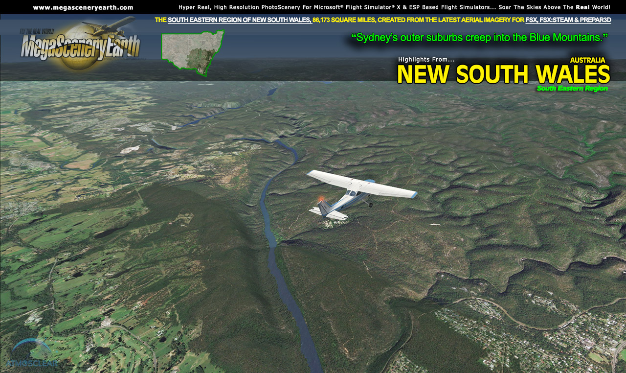
State Parks & National Forests: Blue Mountains, Kanangra-Boyd, Yengo, Wollemi, Pilliliga, Mungo,
Major Rivers: Murray, Murrumbidgee, Darling, Lachlan, Macquarie, Barwon
Discover the rest of it all for yourself! There's a LOT to see!
This is a download edition with the option to order a DVD disk set or Flash Drive
When you order the DVD disk set or flash drive you will still receive download links. If you do not wish to download, simply wait for your media to arrive in the mail.
Aeronautical Charts
Official aeronautical charts to enhance your enjoyment of this scenery can be downloaded from:
http://www.airservicesaustralia.com/aip/aip.asp?pg=10
Here are the charts that apply to this scenery
VISUAL NAVIGATION CHARTS (VNC, SCALE: 1:500,000): Sydney, Deniliquin, Newcastle, Brisbane
VISUAL TERMINAL CHART (VTC, SCALE 1:250,000): SYDNEY, ALBURY, COFFS HARBOR, NEWCASTLE, TAMWORTH
HIGH ALTITUDE IFR CHARTS: H1, H3
LOW ALTITUDE IFR CHARTS: L2, L3, L4. L5
TERMINAL AREA CHART: 3, 4
PLANNING CHART AUSTRALIA
SPECIFIC APPROACH CHARTS & AIRPORT DIAGRAMS
|